File:Br-110mapa.jpg
Size of this preview: 548 × 599 pixels. Other resolutions: 220 × 240 pixels | 439 × 480 pixels | 914 × 999 pixels.
Original file (914 × 999 pixels, file size: 118 KB, MIME type: image/jpeg)
| This is a file from the Wikimedia Commons. Information from its description page there is shown below. Commons is a freely licensed media file repository. You can help. |
Summary
| Description |
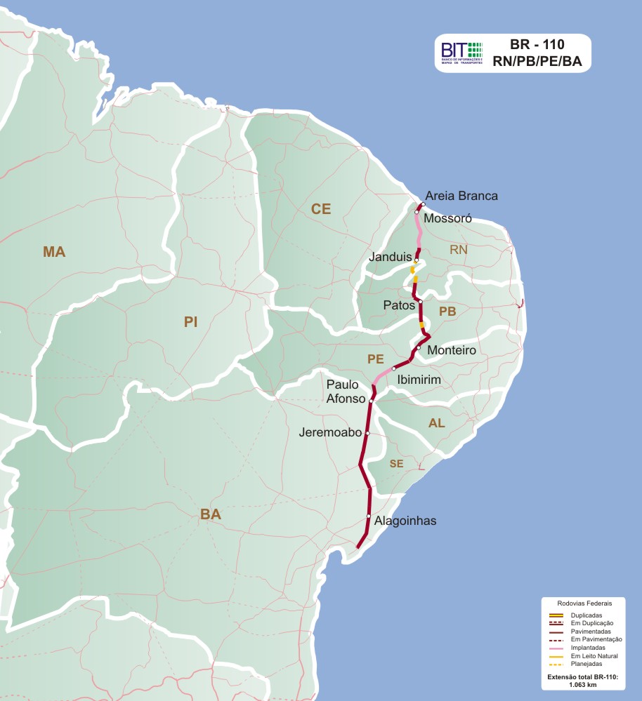
English: Map of BR-110
Português: Mapa descritivo da BR-110 |
| Source | http://www2.transportes.gov.br/bit/02-rodo/3-loc-rodo/loc-rodo/110.htm |
| Author | Ministério dos Transportes |
Licensing
| This work has been released into the public domain by its author, MINISTÉRIO DOS TRANSPORTES. This applies worldwide. In some countries this may not be legally possible; if so: MINISTÉRIO DOS TRANSPORTES grants anyone the right to use this work for any purpose, without any conditions, unless such conditions are required by law.
|
File history
Click on a date/time to view the file as it appeared at that time.
| Date/Time | Thumbnail | Dimensions | User | Comment | |
|---|---|---|---|---|---|
| current | 00:27, 19 August 2014 | | 914 × 999 (118 KB) | Ricardo630 | New version |
| 16:49, 26 February 2009 |  | 1,259 × 1,124 (73 KB) | Skide~commonswiki | ((Information |Description=((en|1=Map of BR-110)) ((pt|1=Mapa descritivo da BR-110)) |Source=http://www.transportes.gov.br/bit/trodo/br-110/gbr-110.htm |Author=Ministério dos Transportes |Date= |Permission=free |other_versions= )) <!--((ImageUpload|full |
File usage
The following pages on the English Wikipedia use this file (pages on other projects are not listed):
Global file usage
The following other wikis use this file:
- Usage on es.wikipedia.org
- Usage on fr.wikipedia.org
- Usage on lmo.wikipedia.org
- Usage on nl.wikipedia.org
- Usage on www.wikidata.org
Metadata
Text is available under the CC BY-SA 4.0 license; additional terms may apply.
Images, videos and audio are available under their respective licenses.
Cover photo is available under {{::mainImage.info.license.name || 'Unknown'}} license.
Cover photo is available under {{::mainImage.info.license.name || 'Unknown'}} license.
Credit:
(see original file).
