File:Bacia do rio Doce com municípios.png
Size of this preview: 800 × 566 pixels. Other resolutions: 320 × 226 pixels | 640 × 453 pixels | 1,024 × 724 pixels | 1,280 × 905 pixels | 2,560 × 1,810 pixels | 3,507 × 2,480 pixels.
Original file (3,507 × 2,480 pixels, file size: 1.21 MB, MIME type: image/png)
| This is a file from the Wikimedia Commons. Information from its description page there is shown below. Commons is a freely licensed media file repository. You can help. |
Summary
| Description |
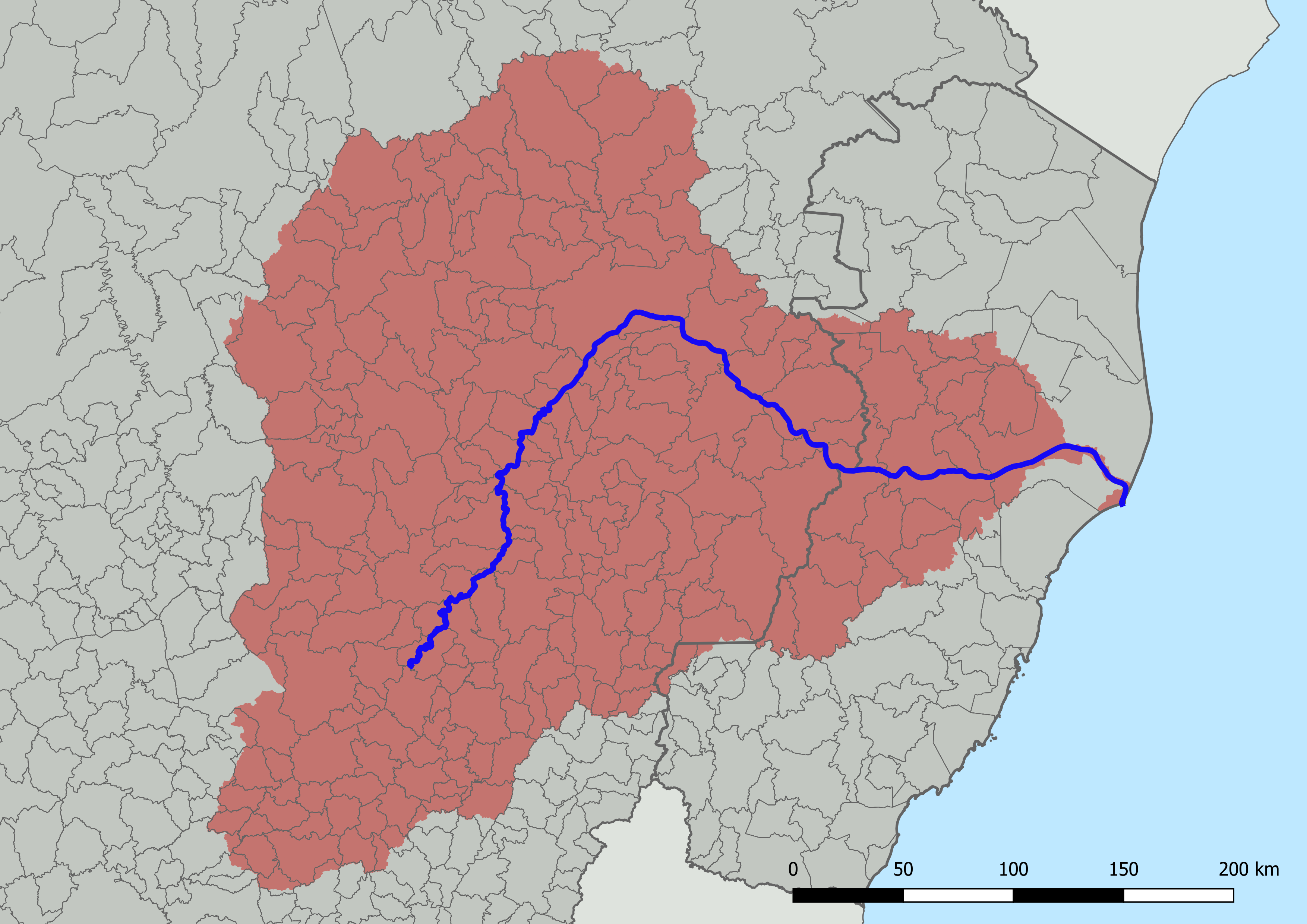
English: Map of the Doce River basin, Brazil, with division into municipalities. Created with QGIS.
Português: Mapa da bacia do rio Doce, Brasil, com divisão em municípios. Criado em QGIS. |
| Date | |
| Source |
Own work; based on GIS data:
|
| Author | HVL |
Licensing
I, the copyright holder of this work, hereby publish it under the following license:
This file is licensed under the Creative Commons Attribution 4.0 International license.
- You are free:
- to share – to copy, distribute and transmit the work
- to remix – to adapt the work
- Under the following conditions:
- attribution – You must give appropriate credit, provide a link to the license, and indicate if changes were made. You may do so in any reasonable manner, but not in any way that suggests the licensor endorses you or your use.
File history
Click on a date/time to view the file as it appeared at that time.
| Date/Time | Thumbnail | Dimensions | User | Comment | |
|---|---|---|---|---|---|
| current | 14:16, 17 July 2022 | | 3,507 × 2,480 (1.21 MB) | HVL | == ((int:filedesc)) == ((Information |description =((en|1=Map of the Doce River basin, Brazil, with division into municipalities. Created with QGIS.)) ((pt|1=Mapa da bacia do rio Doce, Brasil, com divisão em municípios. Criado em QGIS.)) |date =2022-07-17 |source =((own)); based on GIS data: * Instituto Pristino. ''Sistema WebGis de livre acesso ao banco de dados ambiental'' (in portuguese). Available in:<https://institutopristino.org.br/atlas/municipios-de-minas-gerais/>. A... |
File usage
The following pages on the English Wikipedia use this file (pages on other projects are not listed):
Global file usage
The following other wikis use this file:
- Usage on ar.wikipedia.org
- Usage on be.wikipedia.org
- Usage on de.wikipedia.org
- Usage on eo.wikipedia.org
- Usage on ga.wikipedia.org
- Usage on it.wikipedia.org
- Usage on pt.wikipedia.org
- Usage on uk.wikipedia.org
- Usage on uz.wikipedia.org
- Usage on www.wikidata.org
Metadata
Text is available under the CC BY-SA 4.0 license; additional terms may apply.
Images, videos and audio are available under their respective licenses.
Cover photo is available under {{::mainImage.info.license.name || 'Unknown'}} license.
Cover photo is available under {{::mainImage.info.license.name || 'Unknown'}} license.
Credit:
(see original file).
