Dundonald Road tram stop
Dundonald Road | |
|---|---|
 | |
| General information | |
| Location | Dundonald Road, Wimbledon, Merton United Kingdom |
| Operated by | Tramlink |
| Platforms | 2 |
| Construction | |
| Accessible | Yes |
| Other information | |
| Fare zone | London fare zones 3, 4, 5 and 6 |
| History | |
| Opened | 2000 |
| Passengers | |
| 2009–10 | 0.231 million total boardings and alightings[1] |
| 2010–11 | |
This article needs additional citations for verification. Relevant discussion may be found on the talk page. Please help improve this article by adding citations to reliable sources. Unsourced material may be challenged and removed.Find sources: "Dundonald Road tram stop" – news · newspapers · books · scholar · JSTOR (February 2020) (Learn how and when to remove this message)
Dundonald Road tram stop is a stop on the Tramlink service to the south of Wimbledon town centre, in the London Borough of Merton. Access is direct from the pavement on the north side of Dundonald Road at the site of the old level crossing (where the old, now demolished, signal box used to stand on the south side). [citation needed]
At this point, the track follows the route of the old West Croydon to Wimbledon Line, although there was no station on the Dundonald Road site. [citation needed]
The tram stop is near Dundonald Park and the Dundonald Primary School.
The stop was one of the 15 request stops on Tramlink until 15 December 2019, when it became a stop for all trams.[citation needed]
Gallery
[edit]-
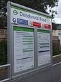 The station's information board.
 -
 Dundonald Rd tramstop in 2006


| Preceding station | Following station | |||
|---|---|---|---|---|
| Wimbledon Terminus
|
Tramlink Wimbledon to Beckenham Junction |
Merton Park towards Beckenham Junction
| ||
| Tramlink Wimbledon to Elmers End |
Merton Park towards Elmers End
| |||
References
[edit]Wikimedia Commons has media related to Dundonald Road tram stop.
- ^ "Tram Stop Usage 2009-10 (FOI)" (XLS). Tramlink annual passenger performance 2009-2010. Transport for London. 18 August 2011. Retrieved 28 November 2012.
- ^ "Tramlink numbers 2010-2011" (PDF). Tramlink annual passenger performance 2010-2011. Transport for London. 28 March 2012. Retrieved 28 November 2012.
| Tram stops |
| ||||||||
|---|---|---|---|---|---|---|---|---|---|
| Proposed developments |
| ||||||||
| Rolling stock | |||||||||
| Related topics | |||||||||
51°25′03″N 0°12′28″W / 51.4176°N 0.2077°W
Text is available under the CC BY-SA 4.0 license; additional terms may apply.
Images, videos and audio are available under their respective licenses.
Cover photo is available under {{::mainImage.info.license.name || 'Unknown'}} license.
Cover photo is available under {{::mainImage.info.license.name || 'Unknown'}} license.
Credit:
(see original file).
