Danao, Bohol
Danao | |
|---|---|
| Municipality of Danao | |
 Danao, Bohol | |
 Flag | |
 Map of Bohol with Danao highlighted | |
OpenStreetMap  | |
.svg) Danao Location within the Philippines | |
| Coordinates: 10°01′N 124°16′E / 10.02°N 124.27°E | |
| Country | Philippines |
| Region | Central Visayas |
| Province | Bohol |
| District | 2nd district |
| Founded | 16 March 1961 |
| Barangays | 17 (see Barangays) |
| Government | |
| • Type | Sangguniang Bayan |
| • Mayor | Jose G. Cepedoza |
| • Vice Mayor | Albert B. Vitor |
| • Representative | Erico Aristotle C. Aumentado |
| • Municipal Council | Members |
| • Electorate | 13,834 voters (2022) |
| Area | |
| • Total | 162.76 km2 (62.84 sq mi) |
| Elevation | 143 m (469 ft) |
| Highest elevation | 424 m (1,391 ft) |
| Lowest elevation | 57 m (187 ft) |
| Population (2020 census)[3] | |
| • Total | 20,245 |
| • Density | 120/km2 (320/sq mi) |
| • Households | 4,446 |
| Economy | |
| • Income class | 4th municipal income class |
| • Poverty incidence | 33.61 |
| • Revenue | ₱ 115.5 million (2020) |
| • Assets | ₱ 236.7 million (2020) |
| • Expenditure | ₱ 127.7 million (2020) |
| • Liabilities | ₱ 68.54 million (2020) |
| Service provider | |
| • Electricity | Bohol 2 Electric Cooperative (BOHECO 2) |
| Time zone | UTC+8 (PST) |
| ZIP code | 6344 |
| PSGC | |
| IDD : area code | +63 (0)38 |
| Native languages | Boholano dialect Cebuano Tagalog |
Danao, officially the Municipality of Danao (Cebuano: Munisipalidad sa Danao; Tagalog: Bayan ng Danao), is a 4th class municipality in the province of Bohol, Philippines. According to the 2020 census, it has a population of 20,245 people.[3]
Danao celebrates its fiesta on December 10, to honor the town patron the Holy Family.[5]
Etymology
According to the Diccionario Español-Bisaya (1866), danao means charca, lago, laguna, pantano, estanque grande, avenida, campañas, etc. (lake, lagoon, freshet, large reservoir, arable land, field, etc.). Except that of a lake, all definitions of danao describe the municipality of Danao, with freshet being the most likely meaning. A freshet is either a sudden rise or overflow of a stream or river, or freshwater stream emptying into the sea.[6]
History
In the beginning, Danao is part of Inabanga, when the latter became a town in 1724.[7] In 1744, Francisco Dagohoy (Sendrijas) established the First Bohol Republic[8] at Caylagan Cave (now Francisco Dagohoy Cave)[9] in barangay Magtangtang, located northwest of the present-day Poblacion. Magtangtang became the seat of government and headquarters of the independent Bohol that lasted for more than 85 years.[10]
In 1830, Talibon became an independent pueblo from Inabanga,[11] and Danao was annexed to it. During the first US sponsored Census, Danao is listed as one of the barrios of Talibon with a recorded population of 585 in 1903.[12]
In 1953, the town of Victoria (now Dagohoy, Bohol) was established and 5 barangays namely Cantubod, Danao, Hibale, Santa Fe, and Santo Niño were carved out from Talibon through Executive Order No. 634[13] by President Elpidio Quirino to form a new municipality together with other 13 barangays in Carmen, Sierra Bullones, Trinidad, and Ubay. However, after only less than 3 years of existence, Victoria was reorganized and became the new municipality of Dagohoy. The 5 barangays were reverted to Talibon through Executive Order No. 184[14] by President Ramon Magsaysay and upon the recommendation of the Provincial Board of Bohol.
Finally, on March 14, 1961, Danao became an independent municipality through Executive Order No. 422 by President Carlos P. Garcia. Sixteen (16) barangays from municipalities of Talibon, Inabanga, and Carmen with the seat of government at barangay Danao were organized into a new town. The list of barangays are shown below:[15]
| From Talibon | From Inabanga | From Carmen | |
|---|---|---|---|
| Cantubod | Remedios | Bongbong (Carbon) | Anunciado (Villa Anunciado) |
| Concepcion | San Carlos | Cabatoan (Cabatuan) | |
| Dagohoy | San Miguel | Nahud | |
| Danao (Poblacion) | Santa Fe | San Roque (Magtangtang and Tabok) | |
| Hibale | Santo Niño | Taming | |
Geography
The Isumod river flowing near the town center of Danao may suddenly overflow and inundate a large portion of the town. The river joins the Wahig river and empties into the sea. Danao is 123 kilometres (76 mi) from Tagbilaran.
Barangays
Danao is politically subdivided into 17 barangays. Each barangay consists of puroks and some have sitios.
| PSGC | Barangay | Population | ±% p.a. | |||
|---|---|---|---|---|---|---|
| 2020[3] | 2010[16] | |||||
| 071218001 | Cabatuan | 7.1% | 1,428 | 1,353 | 0.54% | |
| 071218002 | Cantubod | 5.2% | 1,047 | 1,061 | −0.13% | |
| 071218003 | Carbon | 1.9% | 384 | 513 | −2.85% | |
| 071218004 | Concepcion | 8.0% | 1,623 | 1,566 | 0.36% | |
| 071218005 | Dagohoy | 3.3% | 659 | 685 | −0.39% | |
| 071218006 | Hibale | 4.2% | 843 | 856 | −0.15% | |
| 071218007 | Magtangtang | 6.2% | 1,256 | 1,422 | −1.23% | |
| 071218008 | Nahud | 4.8% | 966 | 855 | 1.23% | |
| 071218009 | Poblacion | 17.0% | 3,434 | 3,296 | 0.41% | |
| 071218010 | Remedios | 6.4% | 1,288 | 1,220 | 0.54% | |
| 071218011 | San Carlos | 5.8% | 1,170 | 1,236 | −0.55% | |
| 071218012 | San Miguel | 2.8% | 559 | 499 | 1.14% | |
| 071218013 | Santa Fe | 2.8% | 567 | 526 | 0.75% | |
| 071218014 | Santo Niño | 3.6% | 719 | 748 | −0.39% | |
| 071218015 | Tabok | 4.7% | 946 | 1,060 | −1.13% | |
| 071218016 | Taming | 4.6% | 932 | 863 | 0.77% | |
| 071218017 | Villa Anunciado | 0.6% | 112 | 150 | −2.88% | |
| Total | 20,245 | 17,952 | 1.21% | |||
Climate
| Climate data for Dagohoy, Bohol | |||||||||||||
|---|---|---|---|---|---|---|---|---|---|---|---|---|---|
| Month | Jan | Feb | Mar | Apr | May | Jun | Jul | Aug | Sep | Oct | Nov | Dec | Year |
| Mean daily maximum °C (°F) | 27 (81) |
28 (82) |
29 (84) |
30 (86) |
31 (88) |
30 (86) |
29 (84) |
30 (86) |
30 (86) |
29 (84) |
28 (82) |
28 (82) |
29 (84) |
| Mean daily minimum °C (°F) | 23 (73) |
22 (72) |
22 (72) |
23 (73) |
24 (75) |
24 (75) |
24 (75) |
23 (73) |
23 (73) |
23 (73) |
23 (73) |
23 (73) |
23 (73) |
| Average precipitation mm (inches) | 98 (3.9) |
82 (3.2) |
96 (3.8) |
71 (2.8) |
104 (4.1) |
129 (5.1) |
101 (4.0) |
94 (3.7) |
99 (3.9) |
135 (5.3) |
174 (6.9) |
143 (5.6) |
1,326 (52.3) |
| Average rainy days | 18.0 | 14.1 | 17.1 | 16.8 | 23.7 | 25.7 | 25.8 | 23.3 | 24.2 | 25.9 | 24.0 | 20.6 | 259.2 |
| Source: Meteoblue (modeled/calculated data, not measured locally)[17] | |||||||||||||
Demographics
| Year | Pop. | ±% p.a. |
|---|---|---|
| 1970 | 7,362 | — |
| 1975 | 8,447 | +2.80% |
| 1980 | 10,298 | +4.04% |
| 1990 | 12,671 | +2.10% |
| 1995 | 14,042 | +1.94% |
| 2000 | 17,265 | +4.53% |
| 2007 | 17,716 | +0.36% |
| 2010 | 17,952 | +0.48% |
| 2015 | 17,890 | −0.07% |
| 2020 | 20,245 | +2.46% |
| Source: Philippine Statistics Authority[18][16][19][20] | ||
Economy
Poverty incidence of Danao
10
20
30
40
50
60
70
2006
64.70 2009
62.09 2012
42.74 2015
35.08 2018
29.20 2021
33.61 Source: Philippine Statistics Authority[21][22][23][24][25][26][27][28] |
Tourism
- Bohol Sea of Clouds: A picturesque ocean-like view of clouds on top of Laguna Hills at barangay Concepcion which about 5 kilometers from the town proper. This majestic occurrence is much observable from 4 to 6 o'clock in the morning which happens throughout the year whenever the weather is fine. It requires visitors to have a 10-minute walk to reach the top the hill.[29][30]
- Dagohoy Historical Marker: A historical marker on Dagohoy's grave in the mountains installed in his honor. The Dagohoy Marker located in barangay Magtangtang, was installed by the Philippine Historical Commission to honor the heroic deeds of Dagohoy. Magtangtang was Francisco Dagohoy's headquarters or hideout during the revolt. Hundreds of Dagohoy's followers preferred death inside the cave than surrender. Their skeletons still remain in the site.[9]
- Eco, Extreme, and Educational Adventure Tour (EAT) Danao offers a great new experience of Bohol. One can soar across one of Bohol's most attractive gorges like a bird; raft or canoe on a river; explore caves; practice mountain climbing, both on a wall, and on real cliffs; and explore some of the wildest spots of the island.[31] This 144-hectare property is located in Magtangtang which is about 10 kilometers from the town proper, and managed by the local government unit.[32]
- Francisco Dagohoy Cave: Formerly known as Caylagan cave, the site served as the headquarter of the independent Bohol Republic established by the great Boholano hero, Francisco Dagohoy in 1744. Dagohoy rebellion is the longest revolt in the Philippines which lasted 85 years from 1744 to 1829. The cave is said to be the passageway to other few more caves in the province. However, such passageways were merely inaccessible due to previous earthquakes that badly hit the area.[33]
- Kamira Cave: Similar to Caylagan cave, the site is located in barangay Magtangtang. It is a 477-meter long cave and will take 45 minutes to explore. Characterized by the presence of narrow passages; stalactites and stalagmites; bats, and freshwater crabs, the place is a marvel and allow visitors to experience wonders of nature. The icy cold water that flows through the cave also provides a chilly feeling.[33]
Education
-
- Cabatuan Elementary School
- Cantubod Elementary School
- Carbon Primary School
- Concepcion Elementary School
- Dagohoy Elementary School
- Danao Central Elementary School
- Hibale Elementary School
- Magtangtang Elementary School
- Nahud Elementary School
- Remedios Primary School
- San Carlos Elementary School
- San Miguel Primary School
- Santa Fe Primary School
- Santo Niño Primary School
- Tabok Elementary School
- Taming Elementary School
- Villa Anunciado Primary School
-
- Cantubod National High School
- Danao National High School
- Francisco Dagohoy Memorial High School[34]
- Taming National High School
Galleries
-
 Municipal hall
 -
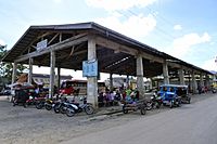 Bus terminal


Text is available under the CC BY-SA 4.0 license; additional terms may apply.
Images, videos and audio are available under their respective licenses.
