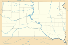
Custer County Airport
Custer County Airport | |||||||||||
|---|---|---|---|---|---|---|---|---|---|---|---|
| Summary | |||||||||||
| Airport type | Public | ||||||||||
| Location | Custer, South Dakota | ||||||||||
| Opened | January 9, 1969 | ||||||||||
| Elevation AMSL | 5,620 ft / 1,713 m | ||||||||||
| Coordinates | 43°44′1.18″N 103°37′10.20″W / 43.7336611°N 103.6195000°W | ||||||||||
| Map | |||||||||||
| Runways | |||||||||||
| |||||||||||
Custer County Airport (ICAO: KCUT, FAA LID: CUT) is a public-use airport located 2 mi (3.2 km) southwest of Custer, South Dakota, United States.[1]
Although most U.S. airports use the same three-letter location identifier for the FAA, ICAO and IATA, Custer County Airport is assigned CUT by the FAA and KCUT by the ICAO but has no designation from the IATA.[2]
Facilities
[edit]Custer County Airport covers an area of 86 acres (35 ha) which contains one asphalt paved runway (08/26) measuring 5,500 ft × 60 ft (1,676 m × 18 m).[1]
Climate
[edit]| Climate data for Custer County Airport, South Dakota, 1991–2020 normals: 5545ft (1690m) | |||||||||||||
|---|---|---|---|---|---|---|---|---|---|---|---|---|---|
| Month | Jan | Feb | Mar | Apr | May | Jun | Jul | Aug | Sep | Oct | Nov | Dec | Year |
| Record high °F (°C) | 65 (18) |
61 (16) |
72 (22) |
81 (27) |
88 (31) |
96 (36) |
99 (37) |
95 (35) |
94 (34) |
82 (28) |
73 (23) |
63 (17) |
99 (37) |
| Mean maximum °F (°C) | 55.0 (12.8) |
52.1 (11.2) |
63.0 (17.2) |
72.1 (22.3) |
80.8 (27.1) |
88.8 (31.6) |
92.6 (33.7) |
90.3 (32.4) |
86.3 (30.2) |
75.1 (23.9) |
64.4 (18.0) |
54.0 (12.2) |
93.7 (34.3) |
| Mean daily maximum °F (°C) | 35.2 (1.8) |
35.2 (1.8) |
43.5 (6.4) |
50.1 (10.1) |
59.6 (15.3) |
71.1 (21.7) |
79.2 (26.2) |
77.8 (25.4) |
69.0 (20.6) |
54.1 (12.3) |
42.9 (6.1) |
34.9 (1.6) |
54.4 (12.4) |
| Daily mean °F (°C) | 25.1 (−3.8) |
25.1 (−3.8) |
32.9 (0.5) |
39.3 (4.1) |
48.6 (9.2) |
58.9 (14.9) |
66.5 (19.2) |
64.7 (18.2) |
55.9 (13.3) |
43.0 (6.1) |
32.6 (0.3) |
25.2 (−3.8) |
43.2 (6.2) |
| Mean daily minimum °F (°C) | 15.0 (−9.4) |
15.0 (−9.4) |
22.2 (−5.4) |
28.5 (−1.9) |
37.5 (3.1) |
46.7 (8.2) |
53.7 (12.1) |
51.6 (10.9) |
42.9 (6.1) |
31.8 (−0.1) |
22.2 (−5.4) |
15.5 (−9.2) |
31.9 (0.0) |
| Mean minimum °F (°C) | −8.4 (−22.4) |
−10.8 (−23.8) |
2.0 (−16.7) |
11.0 (−11.7) |
22.6 (−5.2) |
34.0 (1.1) |
43.0 (6.1) |
39.7 (4.3) |
28.8 (−1.8) |
12.1 (−11.1) |
1.1 (−17.2) |
−7.8 (−22.1) |
−17.7 (−27.6) |
| Record low °F (°C) | −23 (−31) |
−29 (−34) |
−16 (−27) |
−4 (−20) |
12 (−11) |
30 (−1) |
37 (3) |
31 (−1) |
21 (−6) |
−10 (−23) |
−14 (−26) |
−24 (−31) |
−29 (−34) |
| Average precipitation inches (mm) | 0.41 (10) |
0.59 (15) |
0.91 (23) |
2.42 (61) |
2.97 (75) |
3.16 (80) |
3.29 (84) |
2.12 (54) |
1.59 (40) |
1.29 (33) |
0.52 (13) |
0.48 (12) |
19.75 (500) |
| Source 1: NOAA[3] | |||||||||||||
| Source 2: XMACIS (records & monthly max/mins)[4] | |||||||||||||
See also
[edit]References
[edit]- ^ a b c FAA Airport Form 5010 for CUT PDF, effective 2007-07-05
- ^ Circle Mapper: CUT - Custer, South Dakota
- ^ "Custer County Airport, South Dakota 1991-2020 Monthly Normals". Retrieved December 18, 2023.
- ^ "xmACIS". National Oceanic and Atmospheric Administration. Retrieved December 18, 2023.
External links
[edit]- Resources for this airport:
- FAA airport information for CUT
- AirNav airport information for CUT
- FlightAware airport information and live flight tracker
- SkyVector aeronautical chart for CUT
Text is available under the CC BY-SA 4.0 license; additional terms may apply.
Images, videos and audio are available under their respective licenses.


