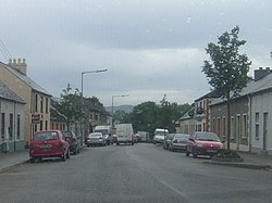
Carrigans, County Donegal
Carrigans
An Carraigín | |
|---|---|
Village | |
 | |
| Coordinates: 54°57′06″N 7°25′43″W / 54.951656°N 7.428532°W | |
| Country | Ireland |
| Province | Ulster |
| County | County Donegal |
| Government | |
| • Dáil Éireann | Donegal |
| Population | |
| • Urban | 331 |
| Time zone | UTC+0 (WET) |
| • Summer (DST) | UTC-1 (IST (WEST)) |
| Website | www |
Carrigans (Irish: An Carraigín, meaning 'little rock')[2] is a village in The Laggan, a district in the east of County Donegal, Ireland. The village is located on the R236 regional road only a short distance from the River Foyle.
History
[edit]Carrigans was at one time[when?] the centre of a major flax and linen producing area, possessing one of the largest flax mills in County Donegal, before the demise of the flax industry in the 1950s.[citation needed] Commercial salmon fishing was also a major employer in the past.[citation needed]
Killea (St. Fiach's) Parish Church (Church of Ireland) is in the village of Carrigans. [citation needed]
Carrigans once had a railway station, the village being served by the Great Northern Railway, which closed in 1965.[citation needed]
The Bangalore torpedo, an explosive device used in many conflicts, was invented by Captain (later Colonel) McClintock, of Dunmore, Carrigans. [citation needed]
Carrigans was one of several Protestant villages in eastern Donegal that would have been transferred to Northern Ireland, had the recommendations of the Irish Boundary Commission been enacted in 1925.[3]
Notable residents
[edit]- Dunmore House, on the edge of the village, was formerly the home of the McClintock dynasty, an Ulster-Scots family. It is now owned by Sir John McFarland, 3rd Bt.[citation needed]
- Sir Jim Starritt, a former Deputy Commissioner of the Metropolitan Police, was born in Carrigans.[citation needed]
- The writer Dame Agatha Christie visited Carrigans on a few occasions, as a guest of the McClintocks of Dunmore, to whom she was related through marriage.[citation needed]
See also
[edit]External links
[edit]References
[edit]- ^ "Census 2016 Sapmap Area: Settlements Carrigans". Central Statistics Office (Ireland). Retrieved 16 June 2018.
- ^ "An Carraigín/Carrigans". Placenames Database of Ireland. Government of Ireland - Department of Arts, Heritage and the Gaeltacht and Dublin City University. Retrieved 16 June 2018.
- ^ "Irish Boundary Commission Report". National Archives. 1925. pp. 140–43.
Text is available under the CC BY-SA 4.0 license; additional terms may apply.
Images, videos and audio are available under their respective licenses.


