Butte des Morts, Wisconsin
Butte des Morts, Wisconsin | |
|---|---|
Census-designated place | |
 Downtown Butte des Morts | |
 Butte des Morts Location in state of Wisconsin | |
| Coordinates: 44°5′57″N 88°39′14″W / 44.09917°N 88.65389°W | |
| Country | United States |
| State | Wisconsin |
| County | Winnebago |
| Area | |
| • Total | 1.24 sq mi (3.22 km2) |
| • Land | 1.22 sq mi (3.17 km2) |
| • Water | 0.02 sq mi (0.05 km2) |
| Elevation | 775 ft (236 m) |
| Population (2010) | |
| • Total | 962 |
| • Density | 786/sq mi (303.5/km2) |
| Time zone | UTC-6 (Central (CST)) |
| • Summer (DST) | UTC-5 (CDT) |
| ZIP code | 54927 |
| Area code | 920 |
| FIPS code | 55-11500[1] |
| GNIS feature ID | 1562472[2] |
Butte des Morts is an unincorporated census-designated place in the town of Winneconne, in Winnebago County, Wisconsin, United States.[3]
As of the 2010 census, its population was 962.[4] The community is located at the north side of (Big) Lake Butte des Morts[5] on the former route of Wisconsin Highway 110. The name means "hill of the dead" in French.[6] Butte des Morts uses the ZIP code 54927. The Augustin Grignon Hotel, listed on the National Register of Historic Places, is located within the community. Butte des Morts has an area of 1.246 square miles (3.23 km2); 1.225 square miles (3.17 km2) of this is land, and 0.021 square miles (0.054 km2) is water.
Origin of Name
In 1730 French soldiers and Menominee warriors massacred people of the Sauk Nation. The French named the place the Hill of the Dead, or Butte des Morts.[7][8]
Images
[edit]-
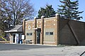
 Post office
 -
 City welcome sign
 -
 Lions club
 -
 Austin Grignon Hotel


References
[edit]- ^ "U.S. Census website". United States Census Bureau. Retrieved January 31, 2008.
- ^ "US Board on Geographic Names". United States Geological Survey. October 25, 2007. Retrieved January 31, 2008.
- ^ "Butte des Morts, WI Profile: Facts & Data".
- ^ "U.S. Census website". U.S. Census Bureau. Retrieved March 29, 2011.
- ^ Lake Butte des Morts
- ^ "Butte des Morts, Lake [origin of place name]". www.wisconsinhistory.org. Archived from the original on June 11, 2011.
- ^ Author(s) unknown. "A Brief History of the Town of Menasha" (PDF). Wisconsin Public Library. pp. 13–14. Retrieved November 11, 2018.
((cite web)):|last=has generic name (help) - ^ Bjornerd, Marcia (2006). Reading the Rocks: The Autobiography of the Earth. New York: Basic Books. p. 2. ISBN 978-0-465-00684-7.
Municipalities and communities of Winnebago County, Wisconsin, United States | ||
|---|---|---|
| Cities |  | |
| Villages | ||
| Towns | ||
| CDPs | ||
| Other communities |
| |
| Former communities | ||
| Indian reservation | ||
| Footnotes | ‡This populated place also has portions in an adjacent county or counties | |
44°05′58″N 88°39′14″W / 44.09944°N 88.65389°W
Text is available under the CC BY-SA 4.0 license; additional terms may apply.
Images, videos and audio are available under their respective licenses.
