Brummen
Brummen | |
|---|---|
 Square in Brummen | |
 Flag  Coat of arms | |
.svg) Location in Gelderland | |
| Coordinates: 52°5′N 6°9′E / 52.083°N 6.150°E | |
| Country | Netherlands |
| Province | Gelderland |
| Government | |
| • Body | Municipal council |
| • Mayor | Alex van Hedel (VVD) |
| Area | |
| • Total | 85.01 km2 (32.82 sq mi) |
| • Land | 83.65 km2 (32.30 sq mi) |
| • Water | 1.36 km2 (0.53 sq mi) |
| Elevation | 10 m (30 ft) |
| Population (January 2021)[4] | |
| • Total | 20,884 |
| • Density | 250/km2 (600/sq mi) |
| Demonym | Brummenaar |
| Time zone | UTC+1 (CET) |
| • Summer (DST) | UTC+2 (CEST) |
| Postcode | 6960–6975, 7399 |
| Area code | 0575 |
| Website | www |

Brummen (Dutch pronunciation: [ˈbrʏmə(n)] ) is a municipality and a village in the eastern Netherlands.
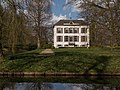
Brummen has a small railway station - Brummen railway station on the line between Zutphen and Arnhem. The village is situated about 7 km (4.3 mi) southwest of Zutphen, no farther than 1.5 km from the IJssel river. About two kilometers west of the village, on the edge of the Veluwe forest area, lies the Engelenburg resort, a castle-like house. It is in use as a hotel for golf players and has a 9-hole golf-link.
Population centres
[edit]- Brummen
- Eerbeek (the largest village in the municipality)
- Empe (which has a small railway station on the line Apeldoorn-Zutphen)
- Hall - with an interesting chapel dating from the Middle Ages
- Leuvenheim
- Oeken
- Tonden
- Voorstonden
Gallery
[edit]-
 Brummen, churchtower (Oude or Sint-Pancratiuskerk)
 -
 Hall, church: Sint Ludgerkerk
 -
 Eerbeek, view to the street: de Stuijvenburchstraat
 -
 Voorstonden, country house: Huis Voorstonden


Transportation
[edit]- Brummen railway station is served by 2 trains per hour serving places such as Zutphen, Dieren, Arnhem and Nijmegen.
International relations
[edit]Twin towns — sister cities
[edit]Brummen is twinned with:
Notable people
[edit]- Jan Elias Nicolaas Schimmelpenninck van der Oye (1836 in Brummen – 1914) a Dutch politician
- Cornelis Johannes van Doorn (1837 in Hall – 1906) a Dutch civil engineer and foreign advisor to Meiji period Japan
- Jacob Emil van Hoogstraten (1898 in Eerbeek – 1991) a Dutch public servant in the Dutch East Indies
- Dick Dolman (1935 in Empe – 2019) a Dutch politician
Sport
[edit]- Geurt Schoonman (1896 in Brummen – 1971) a Dutch sports shooter, competed at the 1948 Summer Olympics
- Wiljon Vaandrager (born 1957 in Brummen) a former rower, bronze medallist at the 1984 Summer Olympics
- Stefan Groothuis (born 1981 in Empe) a retired Dutch speed skater, gold medallist at the 2014 Winter Olympics
Gallery
[edit]-
 Arnhemsestraat, Brummen
 -
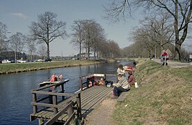 Apeldoorns kanaal ter hoogte van de Brummense brug - Brummen
 -
 Cottage near Hall


References
[edit]- ^ "Burgemeesters en wethouders" [Mayor and aldermen] (in Dutch). Gemeente Brummen. Archived from the original on 2014-07-22. Retrieved 19 June 2014.
- ^ "Kerncijfers wijken en buurten 2020" [Key figures for neighbourhoods 2020]. StatLine (in Dutch). CBS. 24 July 2020. Retrieved 19 September 2020.
- ^ "Postcodetool for 6971BV". Actueel Hoogtebestand Nederland (in Dutch). Het Waterschapshuis. Retrieved 19 June 2014.
- ^ "Bevolkingsontwikkeling; regio per maand" [Population growth; regions per month]. CBS Statline (in Dutch). CBS. 1 January 2021. Retrieved 2 January 2022.
External links
[edit] Media related to Brummen at Wikimedia Commons
- Official website
Places adjacent to Brummen | |
|---|---|

| International | |
|---|---|
| National | |
Text is available under the CC BY-SA 4.0 license; additional terms may apply.
Images, videos and audio are available under their respective licenses.
Cover photo is available under {{::mainImage.info.license.name || 'Unknown'}} license.
Cover photo is available under {{::mainImage.info.license.name || 'Unknown'}} license.
Credit:
(see original file).
