For faster navigation, this Iframe is preloading the Wikiwand page for Belo Monte.

Belo Monte

.mw-parser-output .hidden-begin{box-sizing:border-box;width:100%;padding:5px;border:none;font-size:95%}.mw-parser-output .hidden-title{font-weight:bold;line-height:1.6;text-align:left}.mw-parser-output .hidden-content{text-align:left}@media all and (max-width:500px){.mw-parser-output .hidden-begin{width:auto!important;clear:none!important;float:none!important))You can help expand this article with text translated from the corresponding article in Portuguese. Click [show] for important translation instructions. Machine translation, like DeepL or Google Translate, is a useful starting point for translations, but translators must revise errors as necessary and confirm that the translation is accurate, rather than simply copy-pasting machine-translated text into the English Wikipedia. Do not translate text that appears unreliable or low-quality. If possible, verify the text with references provided in the foreign-language article. You must provide copyright attribution in the edit summary accompanying your translation by providing an interlanguage link to the source of your translation. A model attribution edit summary is Content in this edit is translated from the existing Portuguese Wikipedia article at [[:pt:Belo Monte]]; see its history for attribution. You may also add the template ((Translated|pt|Belo Monte)) to the talk page. For more guidance, see Wikipedia:Translation.
Flag of Belo Monte
Coat of arms of Belo Monte

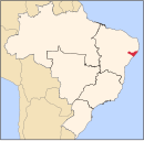
Belo Monte is a municipality located in the western of the Brazilian state of Alagoas. Its population is 6,710 (2020)[1] and its area is 334 km².[2]

The municipality was designated a priority area for conservation and sustainable use when the Caatinga Ecological Corridor was created in 2006.[3]

See also

[edit]

References

[edit]
  1. ^ IBGE 2020
  2. ^ IBGE - "Archived copy". Archived from the original on 2007-01-09. Retrieved 2014-08-03.((cite web)): CS1 maint: archived copy as title (link)
  3. ^ Mattos, Marluza (2006), Ministério cria Corredor Ecológico da Caatinga (in Portuguese), Ministério do Meio Ambiente, retrieved 2016-11-01

09°49′40″S 37°16′48″W / 9.82778°S 37.28000°W / -9.82778; -37.28000

{{bottomLinkPreText}} {{bottomLinkText}}
Belo Monte
Listen to this article

This browser is not supported by Wikiwand :(
Wikiwand requires a browser with modern capabilities in order to provide you with the best reading experience.
Please download and use one of the following browsers:

This article was just edited, click to reload
This article has been deleted on Wikipedia (Why?)

Back to homepage

Please click Add in the dialog above
Please click Allow in the top-left corner,
then click Install Now in the dialog
Please click Open in the download dialog,
then click Install
Please click the "Downloads" icon in the Safari toolbar, open the first download in the list,
then click Install
{{::$root.activation.text}}

Install Wikiwand

Install on Chrome Install on Firefox
Don't forget to rate us

Tell your friends about Wikiwand!

Gmail Facebook Twitter Link

Enjoying Wikiwand?

Tell your friends and spread the love:
Share on Gmail Share on Facebook Share on Twitter Share on Buffer

Our magic isn't perfect

You can help our automatic cover photo selection by reporting an unsuitable photo.

This photo is visually disturbing This photo is not a good choice

Thank you for helping!


Your input will affect cover photo selection, along with input from other users.

X

Get ready for Wikiwand 2.0 🎉! the new version arrives on September 1st! Don't want to wait?