A85 road
| A85 | ||||
|---|---|---|---|---|
 The A85 following Loch Earn near St Fillans | ||||
| Major junctions | ||||
| West end | Oban (NM858298) | |||
| East end | Dundee | |||
| Location | ||||
| Country | United Kingdom | |||
| Primary destinations | Oban, Crianlarich, Lochearnhead, Perth | |||
| Road network | ||||
| ||||
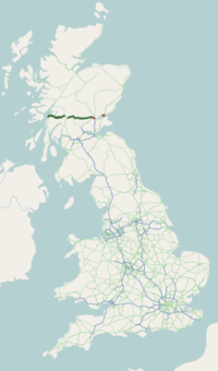
The A85 is a major road in Scotland. It runs east from Oban along the south bank of Loch Etive, through Lochawe and Tyndrum, Crianlarich, Lochearnhead, St Fillans and Crieff before passing through Perth, where it crosses the River Tay via Perth Bridge (West Bridge Street) to Bridgend. Its name between Crieff and Perth is the Crieff Road. It then runs concurrently with the A90 to the Swallow Roundabout, before diverging to follow the Invergowrie Bypass, Riverside Avenue and Riverside Drive before terminating in Dundee city centre.
The A90 road from Perth to Dundee was previously numbered A85;[1] on opening of an upgraded A94 to Aberdeen the A90 number was continued across the Friarton Bridge (previously M85) and on to the A85 route, then from Swallow Roundabout to Aberdeen. The Perth-Dundee stretch was formerly part of the Euroroute system, of route E120 which ran in a circular route between Inverness, Aberdeen, Dundee and Perth.[2]
Between Tyndrum and Crianlarich the road runs concurrently with the A82, where it merges with the main north–south road. Parts follow an old military road. In Oban, it connects with the A816 road.[3]
Some statistics seem to show that the stretch of the A85 between Oban and Tyndrum is among the ten most dangerous roads in Scotland.[4]
Gallery
[edit]-
The A85 crossing Perth Bridge between Perth and Bridgend, looking west from Bridgend
-
The A85 in Oban at blue hour
-
The A85 near Crianlarich in the Stirling Council Area
-
The A85 cantilevered over Loch Awe, Argyll and Bute
-
A bridge in Inverlochy, Lochaber
References
[edit]- ^ Giles, Graeme (18 January 1994). "End of the road for the M85 motorway". Perthshire Advertiser. Retrieved 14 April 2021.
- ^ OS Metric Landranger 1970 and 2010 editions.
- ^ The A816, accessed on 25 August 2024
- ^ "SCOTLAND | Danger road report 'misleading'". BBC News. 18 February 2002. Retrieved 15 June 2012.
External links
[edit] Media related to A85 road (Scotland) at Wikimedia Commons
A roads in Zone 8 of the Great Britain road numbering scheme | ||
|---|---|---|
Text is available under the CC BY-SA 4.0 license; additional terms may apply.
Images, videos and audio are available under their respective licenses.


