Σαβίνια
Συντεταγμένες: 46°5′1.728832189168″N 15°10′19.860649107599″E / 46.08381356449699240°N 15.17218351364100037°E
| Σαβίνια | |
|---|---|
 | |
| Εκβολές | Σάβα |
| Χώρα | Σλοβενία |
| Μήκος | 102 χλμ |
| Παραπόταμοι | Ložnica, Dreta και Bolska |
| wikidata () | |

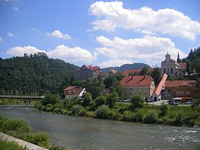
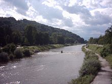
Ο Σαβίνια (σλοβένικα: Savinja) είναι ο μεγαλύτερος σε μήκος ποταμός που ρέει εξ΄ ολοκλήρου στη Σλοβενία. Ρέει στη βορειοανατολική Σλοβενία και κυρίως στην κοιλάδα του Άνω Σαβίνια και κάτω Σαβίνια (σλοβενικά : Zgornja ή Spodnja Savinjska dolina) και μέσα από τις πόλεις του Τσέλιε και Λάσκο. Ο Σαβίνια είναι ο κύριος ποταμός των Σαβίνια Άλπεων (σλοβενικά: Savinjske Alpe). Εκβάλλει στον ποταμό Σάβο στην πόλη Ζιντάνι. Πλημμυρίσει συχνά όπως το 1960, 1990, και το 1995. Ο Σαβίνια έχει μήκος 102 χιλιόμετρα [1].
Ο Σαβίνια προέρχεται από την ένωση του Ρίνκα και ρέει κατά μήκος της κοιλάδας Λογκάρ κι εκβάλλει στον Γερέκα, από αυτό το σημείο δημιουργείται ο ποταμός Σαβίνια. Έχει ανακηρυχθεί μνημείο φυσικής κληρονομιάς και ο καταρράκτης-πηγή του Ρίνκα είναι ένα από τους πιο όμορφους και τα πιο γνωστούς καταρράκτες στη Σλοβενία.
Οι κύριοι παραπόταμοι του Σαβίνια είναι οι Γιουσέφ, Κλόμπασα, Σολτσάβα, Λουτσνίκα, Λούτσε, Λιούμπνιτσα, Ντρέτα, Πάκα, και ο Λοζνίτσα. Το όνομα του πιστεύεται ότι προέρχεται από το όνομα του ποταμού Σάβα κι έχει προ-σλαβική καταγωγή[2].
Παραπομπές
[Επεξεργασία | επεξεργασία κώδικα]- ↑ «Reke, dolge nad 25 km, in njihova padavinska območja» [Rivers, longer than 25 km, and their catchment areas] (στα Slovene και English). Statistical Office of the Republic of Slovenia. 2002. Αρχειοθετήθηκε από το πρωτότυπο στις 20 Οκτωβρίου 2007. Ανακτήθηκε στις 7 Απριλίου 2014.
- ↑ Snoj, Marko. 2009. Etimološki slovar slovenskih zemljepisnih imen. Ljubljana: Modrijan and Založba ZRC, p. 368.
Εξωτερικοί σύνδεσμοι
[Επεξεργασία | επεξεργασία κώδικα] Πολυμέσα σχετικά με το θέμα Savinja στο Wikimedia Commons
- Condition of Savinja at several locations (proceeding from its upper strem to its lower stream):
- Nazarje[νεκρός σύνδεσμος] - graphs, in the following order, of water level and flow data for the past 30 days (taken in Nazarje by Slovenian Environment Agency)
- Letuš - graphs, in the following order, of water level, flow and temperature data for the past 30 days (taken in Letuš by Slovenian Environment Agency)
- Medlog[νεκρός σύνδεσμος] - graphs, in the following order, of water level and temperature data for the past 30 days (taken in Medlog by Slovenian Environment Agency)
- Laško - graphs, in the following order, of water level, flow and temperature data for the past 30 days (taken in Laško by Slovenian Environment Agency)
- Veliko Širje - graphs, in the following order, of water level, flow and temperature data for the past 30 days (taken in Veliko Širje by Slovenian Environment Agency)
Text is available under the CC BY-SA 4.0 license; additional terms may apply.
Images, videos and audio are available under their respective licenses.

