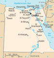
Dataja:Eg-map.png
Eg-map.png (327 × 350 pikselow, wjelikosć dataje: 11 kB, MIME-Typ: image/png)
Stawizny dataje
Tłoc na datum/cas aby tencasna wersija se lodowała.
| datum/cas | Pśeglědowy wobraz | rozměry | Wužywaŕ | Komentar | |
|---|---|---|---|---|---|
| něntejšny | 15. februara 2017, 21:14 |  | 327x350 (11 kB) | StevenJ81 | Reverted to version as of 19:51, 8 June 2010 (UTC): Perspective of map is from other side (see linked pages) |
| 14. januara 2017, 17:39 |  | 327x350 (27 kB) | عادل | Correction of Egyptian borders | |
| 8. junija 2010, 21:51 |  | 327x350 (11 kB) | Ras67 | cropped | |
| 3. měrca 2005, 22:32 |  | 329x352 (12 kB) | Alfio | CIA map of Egypt |
Datajowe wužywanje
Slědujucy bok wótkazujo na toś tu dataju:
Globalne wužywanje datajow
Slědujuce druge wikije wužywaju toś ten wobraz:
- Wužywanje na ar.wikipedia.org
- Wužywanje na azb.wikipedia.org
- Wužywanje na be-tarask.wikipedia.org
- Wužywanje na bg.wikipedia.org
- Wužywanje na bs.wiktionary.org
- Wužywanje na ca.wikipedia.org
- Wužywanje na da.wikipedia.org
- Wužywanje na de.wikivoyage.org
- Wužywanje na diq.wikipedia.org
- Wužywanje na el.wikipedia.org
- Wužywanje na en.wikipedia.org
- Wužywanje na es.wikipedia.org
- Wužywanje na eu.wikipedia.org
- Wužywanje na fiu-vro.wikipedia.org
- Wužywanje na fi.wikipedia.org
- Wužywanje na fr.wikipedia.org
- Wužywanje na fr.wiktionary.org
- Wužywanje na gu.wikipedia.org
- Wužywanje na he.wikipedia.org
- Wužywanje na hi.wikipedia.org
- Wužywanje na hr.wikipedia.org
- Wužywanje na id.wikipedia.org
- Wužywanje na incubator.wikimedia.org
- Wužywanje na io.wikipedia.org
- Wužywanje na it.wikipedia.org
- Wužywanje na it.wiktionary.org
- Wužywanje na ja.wikipedia.org
Dalšne globalne wužywanje toś teje dataje pokazaś.
Text is available under the CC BY-SA 4.0 license; additional terms may apply.
Images, videos and audio are available under their respective licenses.


