Woods Hole (Massachusetts)
aus Wikipedia, der freien Enzyklopädie
| Woods Hole | ||
|---|---|---|
 Woods Hole, Hafen mit Blick auf das WHOI | ||
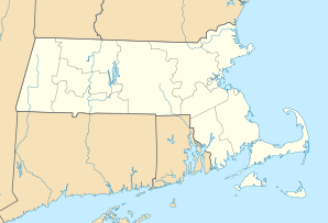
| Lage in Massachusetts | ||
|
| ||
| Basisdaten | ||
| Staat: | Vereinigte Staaten | |
| Bundesstaat: | Massachusetts | |
| County: | Barnstable County | |
| Koordinaten: | 41° 32′ N, 70° 40′ W | |
| Zeitzone: | Eastern (UTC−5/−4) | |
| Einwohner: | 834 (Stand: 2020) | |
| Haushalte: | 485 (Stand: 2020) | |
| Fläche: | 10,19 km² (ca. 4 mi²) davon 5,53 km² (ca. 2 mi²) Land | |
| Bevölkerungsdichte: | 151 Einwohner je km² | |
| Höhe: | 6 m | |
| Postleitzahl: | 02543 | |
| Vorwahl: | +1 508 | |
| FIPS: | 25-81245 | |
| GNIS-ID: | 617060 2378051 | |
| Website: | woodshole.com | |
 Nobska Leuchtturm | ||
Woods Hole ist ein Village und ein CDP an der Südwestspitze von Cape Cod in Massachusetts und gehört als kleiner Hafenort zum Gebiet der Town Falmouth im Barnstable County. Auf dem Gebiet des CDP Woods Hole lebten im Jahr 2020 834 Einwohner[1]
In Woods Hole befindet sich der Sitz mehrerer Forschungseinrichtungen, besonders der Woods Hole Oceanographic Institution (WHOI).
Ursprünglich ein Fischer- und Walfangort, in dem im 19. Jahrhundert auch eine Guano-Fabrik war, dominierten seit Anfang des 20. Jahrhunderts die Sommerhäuser von wohlhabenden Städtern. Hier befinden sich neben der Marineforschungsstation WHOI, die hier seit 1930 ist, das Woods Hole Research Center (gegründet 1985, vor allem Klimawandel), das North East Fisheries Science Center der National Oceanic and Atmospheric Administration, das hier seit 1871 ist, das Marine Biological Laboratory (MBL, seit 1888) und ein Forschungszentrum des US Geological Survey für marine Geologie. Auch die Sea Education Association (SEA), die Schülern Segelschifferfahrung vermittelt, hat hier ihren Sitz. Es gibt ein Aquarium und Ausstellungsräume der Forschungsinstitute (WHOI, MBL) sowie ein Historisches Museum. Der Ort hat einen geschützten Binnenhafen (Pond Eel).
Es gibt in der Nähe einen historischen Leuchtturm, Nobska Light, zuerst erbaut 1828 und neu gebaut 1876. Er ist im National Register of Historic Places und der benachbarte Bau Sitz des Kommandeurs der US Coast Guard für Südost-Neuengland.
Von Woods Hole geht eine Fähre nach Süden auf das benachbarte Martha’s Vineyard.
Weblinks
[Bearbeiten | Quelltext bearbeiten]Einzelnachweise
[Bearbeiten | Quelltext bearbeiten]- ↑ Explore Census Data. In: census.gov. data.census.gov, abgerufen am 3. Oktober 2022.
Text is available under the CC BY-SA 4.0 license; additional terms may apply.
Images, videos and audio are available under their respective licenses.


