Upper West Region
aus Wikipedia, der freien Enzyklopädie
| Upper West Region | |
|---|---|
 | |
| Land | |
| Hauptstadt | Wa |
| Distriktanzahl | 11 |
| Fläche | 18.476 km² |
| Einwohnerzahl | 849.100 (2019) |
| Bevölkerungsdichte | 46 Ew. / km² |
| ISO 3166-2 | GH-UW |
Koordinaten: 10° 30′ N, 2° 0′ W
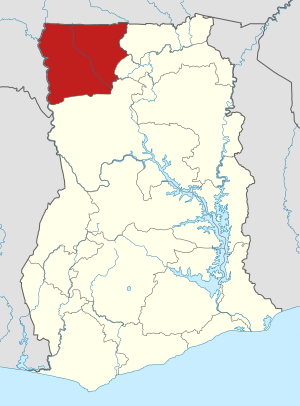
Die Upper West Region (dt. „Obere Westregion“) ist eine Region Ghanas mit der Hauptstadt Wa.
Geografie
[Bearbeiten | Quelltext bearbeiten]Die Region liegt im Nordwesten des Landes und grenzt im Norden und Westen an Burkina Faso, im Süden an die Savannah Region und im Osten an die North East Region und die Upper East Region.
Einwohnerentwicklung
[Bearbeiten | Quelltext bearbeiten]| Zensusjahr | Einwohnerzahl[1] |
|---|---|
| 1960 | 288.706 |
| 1970 | 319.865 |
| 1984 | 438.008 |
| 2000 | 576.583 |
| 2010 | 702.110 |
Administrative Gliederung
[Bearbeiten | Quelltext bearbeiten].svg)
Die Region gliedert sich in elf Distrikte:[2]
| Distrikt | Hauptort |
|---|---|
| Daffiama Bussie Issa | Issa |
| Jirapa Municipal | Jirapa |
| Lambussie Karni | Lambussie |
| Lawra Municipal | Lawra |
| Nadowli Kaleo | Nadowli |
| Nandom Municipal | Nandom |
| Sissala East Municipal | Tumu |
| Sissala West | Gwollu |
| Wa East | Funsi |
| Wa Municipal | Wa |
| Wa West | Wechiau |
Weblinks
[Bearbeiten | Quelltext bearbeiten]Commons: Upper West Region – Sammlung von Bildern, Videos und Audiodateien
- Upper West Region auf ghanadistricts.gov.gh
Einzelnachweise
[Bearbeiten | Quelltext bearbeiten]- ↑ 2010 Population & Housing Census. Archiviert vom (nicht mehr online verfügbar) am 12. Juli 2018; abgerufen am 4. September 2018.
- ↑ Distriktliste auf ghanadistricts.gov.gh, abgerufen am 18. Dezember 2019
Text is available under the CC BY-SA 4.0 license; additional terms may apply.
Images, videos and audio are available under their respective licenses.
Cover photo is available under {{::mainImage.info.license.name || 'Unknown'}} license.
Cover photo is available under {{::mainImage.info.license.name || 'Unknown'}} license.
Credit:
(see original file).
