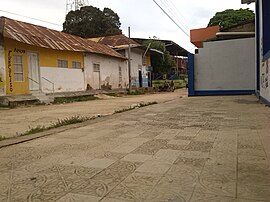
San Onofre (Kolumbien)
aus Wikipedia, der freien Enzyklopädie
| San Onofre | |||
|---|---|---|---|
| |||
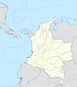
 Lage der Gemeinde San Onofre auf der Karte von Sucre
| |||
| Koordinaten | 9° 44′ 14″ N, 75° 31′ 32″ W | ||
| Basisdaten | |||
| Staat | Kolumbien | ||
| Sucre | |||
| Stadtgründung | 1774 | ||
| Einwohner | 51.991 (2019) | ||
| Stadtinsignien | |||
 | |||
| Detaildaten | |||
| Fläche | 1102 km2 | ||
| Bevölkerungsdichte | 47 Ew./km2 | ||
| Höhe | 30 m | ||
| Gewässer | Karibisches Meer | ||
| Zeitzone | UTC−5 | ||
| Stadtvorsitz | Maida del Carmen Balseiro López (2016–2019) | ||
| Website | |||
 | |||
 | |||
San Onofre ist eine Gemeinde (municipio) im Departamento Sucre in Kolumbien.
Geographie
[Bearbeiten | Quelltext bearbeiten]San Onofre liegt im Nordosten von Sucre, in der Subregion Morrosquillo, 57 km von Sincelejo entfernt, auf einer Höhe von 30 m ü. NN und hat eine Jahresdurchschnittstemperatur von etwa 27 °C. Die Gemeinde grenzt im Norden an Cartagena und Arjona im Departamento de Bolívar, im Süden an den Golf von Morrosquillo, Tolú, Tolú Viejo, Colosó und Chalán, im Osten an María La Baja und El Carmen de Bolívar in Bolívar und im Westen an das Karibische Meer.[1] Zum Gemeindegebiet zählt die Insel Boquerón des San-Bernardo-Archipels.
Bevölkerung
[Bearbeiten | Quelltext bearbeiten]Die Gemeinde San Onofre hat 51.991 Einwohner, von denen 29.853 im städtischen Teil (cabecera municipal) der Gemeinde leben (Stand: 2019).[2]
Geschichte
[Bearbeiten | Quelltext bearbeiten]San Onofre wurde 1774 vom spanischen Hauptmann Antonio de la Torre y Miranda gegründet. Die Region war zu der Zeit bereits von entlaufenen Sklaven besiedelt. Seit 1839 hat San Onofre den Status einer Gemeinde.[1]
Wirtschaft
[Bearbeiten | Quelltext bearbeiten]Die wichtigsten Wirtschaftszweige von San Onofre sind Landwirtschaft, Rinderproduktion und Tourismus, insbesondere Strandtourismus im Corregimiento El Rincón del Mar.[1]
Söhne und Töchter der Stadt
[Bearbeiten | Quelltext bearbeiten]- Rodolfo Blanco (* 1966), ehemaliger kolumbianischer Boxer
Weblinks
[Bearbeiten | Quelltext bearbeiten]- Alcaldía de San Onofre – Sucre. Alcaldía del Municipio de San Onofre – Sucre, abgerufen am 19. April 2019 (spanisch, Webseite der Gemeinde).
Einzelnachweise
[Bearbeiten | Quelltext bearbeiten]- ↑ a b c Nuestro municipio. Alcaldía del Municipio de San Onofre - Sucre, abgerufen am 19. April 2019 (spanisch, Informationen zur Gemeinde).
- ↑ ESTIMACIONES DE POBLACIÓN 1985 - 2005 Y PROYECCIONES DE POBLACIÓN 2005 – 2020 TOTAL DEPARTAMENTAL POR ÁREA. (Excel; 1,72 MB) DANE, 11. Mai 2011, abgerufen am 19. April 2019 (spanisch, Hochrechnung der Einwohnerzahlen von Kolumbien).
Text is available under the CC BY-SA 4.0 license; additional terms may apply.
Images, videos and audio are available under their respective licenses.

