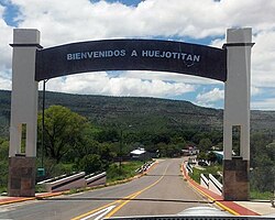
Municipio Huejotitán
aus Wikipedia, der freien Enzyklopädie
| Huejotitán | |
|---|---|

| |
| Basisdaten | |
| Staat | Mexiko |
| Bundesstaat | Chihuahua |
| Sitz | Huejotitán |
| Fläche | 854,3 km² |
| Einwohner | 1049 (2010) |
| Dichte | 1,23 Einwohner pro km² |
| Gründung | 1847 |
| INEGI-Nr. | 08033 |
| Politik | |
| Presidente municipal | Flora Ruiz Corral |
 | |
Koordinaten: 27° 4′ N, 106° 4′ W
Huejotitán ist ein Municipio mit ca. 1000 Einwohnern im mexikanischen Bundesstaat Chihuahua. Das Municipio hat eine Fläche von 854,3 km². Verwaltungssitz und größter Ort des Municipios ist das gleichnamige Huejotitán.
Geographie
[Bearbeiten | Quelltext bearbeiten]Das Municipio Huejotitán liegt im Süden des Bundesstaats Chihuahua auf einer Höhe zwischen 1400 m und 2600 m. Es zählt zur Gänze zur physiographischen Provinz der Sierra Madre Occidental und liegt vollständig in der hydrologischen Region Bravo-Conchos und entwässert damit in den Golf von Mexiko. Die Geologie des Municipios wird zu 42 % von rhyolithischem Tuff bestimmt bei 33 % Kalkstein-Lutit und 17 % Konglomeratgestein; vorherrschende Bodentypen im Municipio sind der Leptosol (58 %), Phaeozem (20 %) und Regosol (11 %). Etwa 76 % des Gemeindefläche werden als Weideland genutzt, 20 % sind bewaldet.
Das Municipio grenzt an die Municipios Rosario, Valle de Zaragoza, Hidalgo del Parral, San Francisco del Oro und El Tule.
Bevölkerung
[Bearbeiten | Quelltext bearbeiten]Beim Zensus 2010 wurden im Municipio 1049 Menschen in 331 Wohneinheiten gezählt. Davon wurden zehn Personen als Sprecher einer indigenen Sprache registriert, darunter acht Sprecher der Tarahumara-Sprache. 9,4 Prozent der Bevölkerung waren Analphabeten. 385 Einwohner wurden als Erwerbspersonen registriert, wovon ca. 90 % Männer bzw. 5,5 % arbeitslos waren. 6,7 Prozent der Bevölkerung lebten in extremer Armut.
Orte
[Bearbeiten | Quelltext bearbeiten]Das Municipio Huejotitán umfasst 119 bewohnte localidades, von denen lediglich der Hauptort vom INEGI als urban klassifiziert ist. Zwei Orte wiesen beim Zensus 2010 eine Einwohnerzahl von über 100 auf: Huejotitán (243 Einwohner) und Pichague (128 Einwohner).
Weblinks
[Bearbeiten | Quelltext bearbeiten]- Enciclopedia de los Municipios y Delegaciones de México: Municipio Huejotitán (spanisch)
- INEGI: Datos Geográficos: Municipio Huejotitán (spanisch; PDF)
Text is available under the CC BY-SA 4.0 license; additional terms may apply.
Images, videos and audio are available under their respective licenses.

