Lumpiaque
aus Wikipedia, der freien Enzyklopädie
| Gemeinde Lumpiaque | |||
|---|---|---|---|
 Lumpiaque – Ortsansicht | |||
| Wappen | Karte von Spanien | ||

|
| ||
| Basisdaten | |||
| Land: | |||
| Autonome Gemeinschaft: | |||
| Provinz: | Saragossa | ||
| Comarca: | Valdejalón | ||
| Gerichtsbezirk: | La Almunia de Doña Godina | ||
| Koordinaten: | 41° 38′ N, 1° 18′ W | ||
| Höhe: | 310 msnm | ||
| Fläche: | 29,55 km² | ||
| Einwohner: | 841 (1. Jan. 2022)[1] | ||
| Bevölkerungsdichte: | 28 Einw./km² | ||
| Postleitzahl(en): | 50295 | ||
| Gemeindenummer (INE): | 50150 | ||
| Verwaltung | |||
| Bürgermeister: | Jesús Martínez Gil (PP) | ||
| Website: | www.lumpiaque.es | ||
| Lage des Ortes | |||
Karte anzeigen  | |||

Lumpiaque ist eine Kleinstadt und eine Gemeinde (municipio) mit insgesamt 841 Einwohnern (Stand 1. Januar 2022) im Norden der Provinz Saragossa in der Autonomen Region Aragonien im Nordosten Spaniens.
Lage und Klima
[Bearbeiten | Quelltext bearbeiten]Lumpiaque liegt etwa 45 Kilometer westsüdwestlich der Provinzhauptstadt Saragossa in einer Höhe von ca. 310 m.
Das Klima ist gemäßigt bis warm; der eher spärliche Regen (ca. 399 mm/Jahr) fällt übers Jahr verteilt.[2]
Bevölkerungsentwicklung
[Bearbeiten | Quelltext bearbeiten]| Jahr | 1970 | 1981 | 1991 | 2001 | 2011 | 2021 |
| Einwohner | 1351 | 1138 | 1004 | 901 | 939 | 836[3] |
Sehenswürdigkeiten
[Bearbeiten | Quelltext bearbeiten]- Franziskuskirche (Iglesia de San Francisco de Asís)
-
 Franziskuskirche
 -
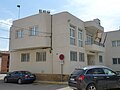 Rathaus


Weblinks
[Bearbeiten | Quelltext bearbeiten]Einzelnachweise
[Bearbeiten | Quelltext bearbeiten]- ↑ Cifras oficiales de población de los municipios españoles en aplicación de la Ley de Bases del Régimen Local (Art. 17). Instituto Nacional de Estadística (Bevölkerungsstatistiken des Instituto Nacional de Estadística, Stand 1. Januar 2022).
- ↑ Lumpiaque – Klimatabellen
- ↑ Lumpiaque – Bevölkerungsentwicklung

Abanto | Acered | Agón | Aguarón | Aguilón | Ainzón | Aladrén | Alagón | Alarba | Alberite de San Juan | Albeta | Alborge | Alcalá de Ebro | Alcalá de Moncayo | Alconchel de Ariza | Aldehuela de Liestos | Alfajarín | Alfamén | Alforque | Alhama de Aragón | Almochuel | Almonacid de la Cuba | Almonacid de la Sierra | Alpartir | Ambel | Anento | Aniñón | Añón de Moncayo | Aranda de Moncayo | Arándiga | Ardisa | Ariza | Artieda | Asín | Atea | Ateca | Azuara | Badules | Bagüés | Balconchán | Bárboles | Bardallur | Belchite | Belmonte de Gracián | Berdejo | Berrueco | Biel | Bijuesca | Biota | Bisimbre | Boquiñeni | Bordalba | Borja | Botorrita | Brea de Aragón | Bubierca | Bujaraloz | Bulbuente | Bureta | Cabañas de Ebro | Cabolafuente | Cadrete | Calatayud | Calatorao | Calcena | Calmarza | Campillo de Aragón | Carenas | Cariñena | Caspe | Castejón de Alarba | Castejón de las Armas | Castejón de Valdejasa | Castiliscar | Cervera de la Cañada | Cerveruela | Cetina | Chiprana | Chodes | Cimballa | Cinco Olivas | Clarés de Ribota | Codo | Codos | Contamina | Cosuenda | Cuarte de Huerva | Cubel | Daroca | Ejea de los Caballeros | El Burgo de Ebro | El Buste | El Frago | El Frasno | Embid de Ariza | Encinacorba | Épila | Erla | Escatrón | Fabara | Farlete | Fayón | Figueruelas | Fombuena | Fréscano | Fuendejalón | Fuendetodos | Fuentes de Ebro | Fuentes de Jiloca | Gallocanta | Gallur | Gelsa | Godojos | Gotor | Grisel | Grisén | Herrera de los Navarros | Ibdes | Illueca | Isuerre | Jaraba | Jarque | Jaulín | La Almolda | La Almunia de Doña Godina | La Joyosa | Lagata | La Muela | Langa del Castillo | La Puebla de Alfindén | Las Cuerlas | Las Pedrosas | La Vilueña | Layana | La Zaida | Lécera | Lechón | Leciñena | Letux | Litago | Lituénigo | Lobera de Onsella | Longares | Longás | Los Fayos | Los Pintanos | Lucena de Jalón | Luceni | Luesia | Luesma | Lumpiaque | Luna | Maella | Magallón | Mainar | Malanquilla | Maleján | Mallén | Malón | Maluenda | Manchones | Mara | María de Huerva | Marracos | Mediana de Aragón | Mequinenza | Mesones de Isuela | Mezalocha | Mianos | Miedes de Aragón | Monegrillo | Moneva | Monreal de Ariza | Monterde | Montón | Morata de Jalón | Morata de Jiloca | Morés | Moros | Moyuela | Mozota | Muel | Munébrega | Murero | Murillo de Gállego | Navardún | Nigüella | Nombrevilla | Nonaspe | Novallas | Novillas | Nuévalos | Nuez de Ebro | Olvés | Orcajo | Orera | Orés | Oseja | Osera de Ebro | Paniza | Paracuellos de Jiloca | Paracuellos de la Ribera | Pastriz | Pedrola | Perdiguera | Piedratajada | Pina de Ebro | Pinseque | Plasencia de Jalón | Pleitas | Plenas | Pomer | Pozuel de Ariza | Pozuelo de Aragón | Pradilla de Ebro | La Puebla de Albortón | Puendeluna | Purujosa | Quinto | Remolinos | Retascón | Ricla | Romanos | Rueda de Jalón | Ruesca | Sabiñán | Sádaba | Salillas de Jalón | Salvatierra de Esca | Samper del Salz | San Martín de la Virgen de Moncayo | San Mateo de Gállego | Santa Cruz de Grío | Santa Cruz de Moncayo | Santa Eulalia de Gállego | Santed | Saragossa | Sástago | Sediles | Sestrica | Sierra de Luna | Sigüés | Sisamón | Sobradiel | Sos del Rey Católico | Tabuenca | Talamantes | Tarazona | Tauste | Terrer | Tierga | Tobed | Torralba de los Frailes | Torralba de Ribota | Torralbilla | Torrehermosa | Torrelapaja | Torrellas | Torres de Berrellén | Torrijo de la Cañada | Tosos | Trasmoz | Trasobares | Uncastillo | Undués de Lerda | Urrea de Jalón | Urriés | Used | Utebo | Val de San Martín | Valdehorna | Valmadrid | Valpalmas | Valtorres | Velilla de Ebro | Velilla de Jiloca | Vera de Moncayo | Vierlas | Villadoz | Villafeliche | Villafranca de Ebro | Villalba de Perejil | Villalengua | Villamayor de Gállego | Villanueva de Gállego | Villanueva de Huerva | Villanueva de Jiloca | Villar de los Navarros | Villarreal de Huerva | Villarroya de la Sierra | Villarroya del Campo | Vistabella | Zuera
Text is available under the CC BY-SA 4.0 license; additional terms may apply.
Images, videos and audio are available under their respective licenses.
