Hessle
aus Wikipedia, der freien Enzyklopädie
| Hessle | ||
|---|---|---|
 | ||
| Koordinaten | 53° 43′ N, 0° 26′ W | |
|
| ||
| Traditionelle Grafschaft | Yorkshire | |
| Einwohner | 14.767 (Stand: 2001) | |
| Verwaltung | ||
| Post town | HESSLE | |
| Postleitzahlenabschnitt | HU13 | |
| Vorwahl | 01482 | |
| Landesteil | England | |
| Region | Yorkshire and the Humber | |
| Shire county | East Riding of Yorkshire | |
| District | East Riding of Yorkshire | |
| Britisches Parlament | Kingston upon Hull West und Hessle | |
| Website: www.thehesslefederation.co.uk | ||
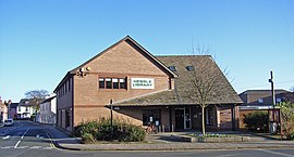
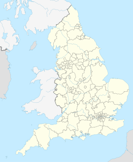
Hessle ist eine Kleinstadt in der englischen Unitary Authority East Riding of Yorkshire. Am Nordufer des Humber gelegen, grenzt sie direkt westlich an Kingston upon Hull und bildet mit der Großstadt praktisch einen einheitlichen urbanen Raum. Hessle besaß bei der Volkszählung im Jahre 2001 14.767 Einwohner.[1]
Geografie
[Bearbeiten | Quelltext bearbeiten]Nachbargemeinden Hessles sind (im Uhrzeigersinn, beginnend im Westen): North Ferriby, Swanland, Anlaby with Anlaby Common und die Großstadt Hull. Am gegenüberliegenden Ufer des Humber liegt der Hafen von New Holland sowie die Kleinstadt Barton-upon-Humber.
Verkehr
[Bearbeiten | Quelltext bearbeiten]
Am südwestlichen Stadtrand verbindet die A15 (Hessle–Peterborough) über die mautpflichtige Humber-Brücke die beiden Ufer des Humber, wodurch das südlich gelegene Lincolnshire schnell zu erreichen ist. Über die sich nördlich fortsetzende A164 erreicht man Driffield über Beverley, und über die A63 (Hull–Leeds) erreicht man den M62, über welchen man Anschluss an das Autobahnnetz Großbritanniens hat.
Hessle besitzt zudem einen Bahnhof, von welchem direkte Zugverbindungen nach Hull, Leeds, Doncaster und York existieren.
Der nächste Flughafen ist der Humberside Airport, welcher sich etwa 30 km südlich in North Lincolnshire befindet.
Hessle ist außerdem Ausgangspunkt des Yorkshire Wolds Way, eines 127 km langen Wanderwegs, welcher über die Yorkshire Wolds nach Filey an die Nordseeküste führt.
Söhne der Stadt
[Bearbeiten | Quelltext bearbeiten]- Stephen C. West (* 1952), Biochemiker
- Nick Dyson (* 1969), Snookerspieler
Einzelnachweise
[Bearbeiten | Quelltext bearbeiten]- ↑ 2001 Census: Key Statistics: Parish Headcounts: Area: Hessle CP (Parish). In: Neighbourhood Statistics. Office for National Statistics, abgerufen am 17. Mai 2008.
Weblinks
[Bearbeiten | Quelltext bearbeiten]- Website der Stadt (englisch)
Text is available under the CC BY-SA 4.0 license; additional terms may apply.
Images, videos and audio are available under their respective licenses.

