Hatohobei
aus Wikipedia, der freien Enzyklopädie
| Hatohobei | |
|---|---|

| |
| Geographie | |
| Staat: | Palau |
| Gewässer: | Pazifischer Ozean |
| Inseln: | Atoll und eine Insel |
| Geographische Lage: | 3° 0′ N, 131° 7′ O |
| Basisdaten | |
| Fläche: | 0,7 km² |
| Einwohner: | 39 (2020)[1] |
| Bevölkerungsdichte: | 56 Einw./km² |
| Hauptstadt: | Hatohobei (Tobi) |
| Lagekarte | |
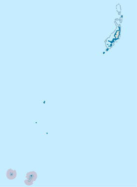 | |
Hatohobei oder Tobi[2] ist ein administrativer „Staat“ (eine Verwaltungseinheit) von Palau. Das aus einer Insel und einem Atoll bestehende Verwaltungsgebiet hat eine Landfläche von nur 0,7 km² und insgesamt 39 Einwohner (Stand 2020).[1] Es liegt knapp 600 km südwestlich von der Hauptinsel Babeldaob.
Hauptort ist das gleichnamige Dorf Hatohobei auf der Insel Tobi. Die Sprachen der Bevölkerung sind Tobianisch und Englisch[3].
Die Gebiete, die zu Hatohobei gehören, bilden mit den etwa 200 km nördlich liegenden Inseln des Staates Sonsorol eine Gruppe, die übersetzt „Südwestinseln von Palau“ heißt.
Zum Staat Hatohobei zählen:
| Inselname | Hauptdorf | Bevölkerung | Landfläche (in km²) | Koordinaten |
|---|---|---|---|---|
| Tobi | Hatohobei | 20 | 0,60 | 3° 0′ N, 131° 7′ O |
| Helen-Riff1 | – | 0 | 0,03 | 2° 54′ N, 131° 48′ O |
| Transit-Riff2 | – | 0 | – | 2° 47′ N, 132° 32′ O |
Anmerkungen:
1 Das Helen-Riff ist ein Atoll mit einer winzigen Landfläche (Helen Island) im Norden.
2 Die Existenz des Transit-Riffs ist umstritten; es ist nicht auf allen Seekarten eingezeichnet.
Einzelnachweise
[Bearbeiten | Quelltext bearbeiten]- ↑ a b Kaleb Udui jr. (Hrsg.): 2021 Statistical Yearbook. Republic of Palau – Bureau of Budget and Planning, Ministry of Finance, 2022, Table 2.2a: Land Area and Population Density by State of Residence: 2020 (englisch, palaugov.pw [PDF; 11,0 MB; abgerufen am 2. Januar 2023]).
- ↑ Tabelle der Wahlergebnisse der Staaten Palaus ( vom 12. Juli 2012 im Webarchiv archive.today)
- ↑ Constitution of Hatohobei State (engl.)
Text is available under the CC BY-SA 4.0 license; additional terms may apply.
Images, videos and audio are available under their respective licenses.
