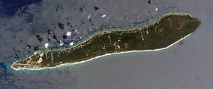
Cayman Brac
aus Wikipedia, der freien Enzyklopädie
| Cayman Brac | ||
|---|---|---|
 | ||
| Gewässer | Karibisches Meer | |
| Inselgruppe | Cayman Islands | |
| Geographische Lage | 19° 43′ N, 79° 48′ W | |
|
| ||
| Länge | 19 km | |
| Breite | 2 km | |
| Fläche | 38,8 km² | |
| Höchste Erhebung | The Bluff 43 m | |
| Einwohner | 2098 (2010) 54 Einw./km² | |
| Hauptort | West End | |
 | ||
Cayman Brac ist die östlichste und mit einer Fläche von 38,8 km² zweitgrößte Insel der Cayman Islands.[1] Sie liegt etwa 140 km nordöstlich der Hauptinsel Grand Cayman. Auf dieser Insel leben 2098 der 55.036 Einwohner der Cayman Islands (Stand 2010).[2]
Cayman Brac ist etwa 19 km lang und durchschnittlich 2 km breit.
Die Insel wurde nach einer Kalksteinklippe benannt. Brac ist das gälische Wort für Klippe.
Auf der Insel befindet sich das Cayman Brac Museum.
Ebenso wie die rund 8 km westlich gelegene Little-Cayman-Insel wurde Cayman Brac 1503 von Christoph Kolumbus entdeckt. Die ersten Bewohner waren britischstämmige Siedler, die um 1660 auf die Insel kamen.[3] Unter anderem wegen der vielen Höhlen wurde die Insel ein beliebtes Piratenversteck, wo oft auch Beute versteckt wurde; bei starken Hurrikans (wie dem des Jahres 1932, der große Verwüstungen anrichtete) wurden die Höhlen jedoch auch als schützender Zufluchtsort genutzt.
Im Südwesten der Insel befindet sich der Charles Kirkconnell International Airport.
Weblinks
[Bearbeiten | Quelltext bearbeiten]- Cayman Brac – A Nature Lovers Paradise. In: visitcaymanislands.com. Cayman Islands Department of Tourism (englisch).
- Brac Facts – Natural Beauty Awaits. In: naturecayman.com. Cayman Islands Government (englisch).
- About the Brac. In: caymanbrac.com. Chris Crumley Productions Inc. (englisch).
Einzelnachweise
[Bearbeiten | Quelltext bearbeiten]- ↑ The Cayman Islands’ Compendium of Statistics 2019. Government of the Cayman Islands – Economics and Statistics Office, August 2020, The Cayman Islands at a Glance: Surface Area, S. 10 (englisch, eso.ky [PDF; 6,1 MB; abgerufen am 2. Juli 2021]).
- ↑ The Cayman Islands’ Compendium of Statistics 2019. Government of the Cayman Islands – Economics and Statistics Office, August 2020, 1.11: Population Density, Census Years 1989 – 2010, S. 22 (englisch, eso.ky [PDF; 6,1 MB; abgerufen am 2. Juli 2021]).
- ↑ Our History. In: gov.ky. Cayman Islands Government, archiviert vom (nicht mehr online verfügbar) am 1. März 2023; abgerufen am 1. Juli 2021 (englisch). Info: Der Archivlink wurde automatisch eingesetzt und noch nicht geprüft. Bitte prüfe Original- und Archivlink gemäß Anleitung und entferne dann diesen Hinweis.
Text is available under the CC BY-SA 4.0 license; additional terms may apply.
Images, videos and audio are available under their respective licenses.

