Avenida Dom Martinho Lopes
aus Wikipedia, der freien Enzyklopädie
| Avenida Dom Martinho Lopes | |
|---|---|
| Straße in Dili | |
 | |
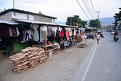
| Straßenhändler in der Avenida Dom Martinho Lopes | |
| Basisdaten | |
| Ort | Dili |
| Ortsteil | Bidau Lecidere, Acadiru Hun |
| Hist. Namen | Estrada de Lecidere, Estrada de Bidau, Rua da Circunvalação |
| Anschlussstraßen | Rua Dom José Ribeiro |
| Querstraßen | Avenida Marginal, Rua 30 de Agosto, Avenida 20 de Maio, Avenida da Liberdade de Imprensa, Avenida de Becora |
| Nutzung | |
| Nutzergruppen | Fußverkehr, Individualverkehr, ÖPNV |
| Technische Daten | |
| Straßenlänge | etwa 1,1 km |
Die Avenida Dom Martinho Lopes ist eine Hauptstraße der osttimoresischen Landeshauptstadt Dili im Verwaltungsamt Nain Feto. Sie hat eine Länge von etwa 1,1 Kilometern.
Name
[Bearbeiten | Quelltext bearbeiten]Dom Martinho da Costa Lopes war von 1977 bis 1983 Apostolischer Administrator von Dili. Bis 2015 trug die Straße den Namen Estrada de Lecidere, nach dem Stadtteil Lecidere, in dessen Richtung sie führt. Davor trugen der erste Teil den Namen Estrada de Bidau (nach dem Stadtteil Bidau) und ab der heutigen Rua 30 de Agosto den Namen Rua da Circunvalação (deutsch Ringstraße).
Verlauf
[Bearbeiten | Quelltext bearbeiten]Die Avenida Dom Martinho Lopes führt von der Bucht von Dili aus in Richtung Süden. Sie beginnt im Suco Bidau Lecidere an der Avenida Marginal und führt entlang des Westufers des Mota Bidau, als Ostgrenze des Verwaltungsamts Nain Feto. Auf dem Ostufer beginnt das Verwaltungsamt Cristo Rei mit den Sucos Bidau Santana und Culu Hun. Nach der Rua 30 de Agosto beginnt der Suco Acadiru Hun. Am Ufer des Mota Bidaus befindet sich hier der Markt Seggol. Hinter der Kreuzung mit der Avenida 20 de Maio liegt auf dem anderen Ufer des Mota Bidaus das Hospital Nacional Guido Valadares, benannt nach dem Freiheitskämpfer und Politiker Guido Valadares (1934–1976). An der Kreuzung mit der Avenida da Liberdade de Imprensa (Nordwesten) und Avenida de Becora (Südosten) führt die Rua Dom José Ribeiro weiter.[1]
Weblinks
[Bearbeiten | Quelltext bearbeiten]Einzelnachweise
[Bearbeiten | Quelltext bearbeiten]Koordinaten: 8° 33′ 12,2″ S, 125° 35′ 27″ O
Text is available under the CC BY-SA 4.0 license; additional terms may apply.
Images, videos and audio are available under their respective licenses.
