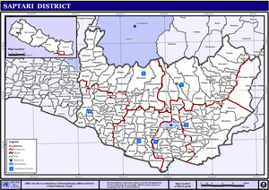
Saptari District
| Saptari District सप्तरी जिल्ला | |
 | |
| Hovedkvarter: | Rajbiraj |
| Areal: | 1.363 km² |
| Befolkning: | 639.284 (2011[1]) |
| Befolkningstæthed: | 469 pr. km² |
| Urent drikkevand: | 5,8 % (2003) |
| Gennemsnitsindtægt: | 172 US$ årl. (2003) |
| Human-developm.-index: | Nr. 41 af 75 (2003) |
| Tidszone: | UTC+5:45 |

Saptari District er et af Nepals 75 administrative og politiske regioner, betegnet distrikter (lokalt betegnet district, zilla, jilla el. जिल्ला). Saptari er et distrikt i lavlandet Terai, som ligger i Sagarmatha Zone i Eastern Development Region.
Saptari areal er 1.363 km² og der boede ved folketællingen 2001 i alt 570.282 og i 2007 637.005 og i 2011 639.284 [1]i distriktet. Distriktets politiske organ District Development Committee er sammensat gennem indirekte valg, med repræsentation fra hver af de 9-17 administrative enheder ilakaer, hvert distrikt er opdelt i.
Saptari District er endvidere opdelt i 115 udviklingskommuner (lokalt navn: Gaun Bikas Samiti (G.B.S.) el. Village Development Committee (VDC)), hvoraf byer med over 10.000 indbyggere kategoriseres som købstæder (municipalities).
Saptari District er udviklingsmæssigt – gennem anvendelse af FN og UNDP's Human Development Index – kategoriseret som nr. 41 ud af Nepals 75 distrikter.
Se også
[redigér | rediger kildetekst]Referencer
[redigér | rediger kildetekst]- ^ a b "Household and population by districts, Central Bureau of Statistics (CBS) Nepal" (PDF). Arkiveret fra originalen (PDF) 13. februar 2015. Hentet 11. maj 2013.
Eksterne links
[redigér | rediger kildetekst] |
Wikimedia Commons har medier relateret til: |
| Bjergdistrikter (16 distrikter) | ||
|---|---|---|
| Bakkeregionen - Middle Hills (36 distrikter) | ||
| Hovedstadsregionen - Kathmandudalen (3 distrikter) | ||
| Lavlandet Terai (20 distrikter) | ||
Listen er opført i geografisk rækkefølge fra vest (til venstre) mod øst (til højre) | ||
| | Spire Denne artikel om Nepals geografi er en spire som bør udbygges. Du er velkommen til at hjælpe Wikipedia ved at udvide den. |
Text is available under the CC BY-SA 4.0 license; additional terms may apply.
Images, videos and audio are available under their respective licenses.

