Fil:LocationWesternAfrica.png
Der findes ingen højere opløsning af billedet
LocationWesternAfrica.png (359 × 359 billedpunkter, filstørrelse: 7 KB, MIME-type: image/png)
|
|
Denne fil er fra Wikimedia Commons. Beskrivelsen af filen fra Commons er gengivet nedenfor. |

|
En vektorversion af dette billede (SVG) er tilgængelig. Det bør bruges i stedet for punktgrafikbilledet når det er fordelagtigt.
File:LocationWesternAfrica.png → File:Africa-countries-western.svg
For mere information om vektorgrafik: Læs om overgangen til SVG på Commons. Se også information om MediaWikis understøttelse af SVG-billeder. |
 |
Beskrivelse
| Beskrivelse |
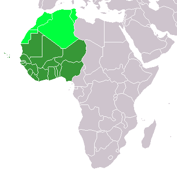
Map: Africa – Western Africa:
|
| Dato | 4. februar 2006 (original upload date) |
| Kilde | No machine-readable source provided. Own work assumed (based on copyright claims). |
| Forfatter | No machine-readable author provided. E Pluribus Anthony~commonswiki assumed (based on copyright claims). |
Licensering
| Jeg, indehaveren af ophavsretten til dette værk, udgiver dette værk som offentlig ejendom. Dette gælder i hele verden. I nogle lande er dette ikke juridisk muligt. I så fald: Jeg giver enhver ret til at anvende dette værk til ethvert formål, uden nogen restriktioner, medmindre sådanne restriktioner er påkrævede ved lov. |
Filhistorik
Klik på en dato/tid for at se filen som den så ud på det tidspunkt.
| Dato/tid | Miniaturebillede | Dimensioner | Bruger | Kommentar | |
|---|---|---|---|---|---|
| nuværende | 11. nov. 2022, 15:17 | | 359 × 359 (7 KB) | ColorfulSmoke | . |
| 11. nov. 2022, 13:56 |  | 360 × 359 (7 KB) | ColorfulSmoke | ||
| 17. mar. 2018, 18:47 |  | 360 × 392 (10 KB) | Maphobbyist | Upload | |
| 31. mar. 2016, 22:54 |  | 360 × 392 (13 KB) | Fry1989 | Reverted to version as of 21:24, 9 July 2011 (UTC) | |
| 16. mar. 2016, 01:24 |  | 360 × 392 (10 KB) | Hpyounes | new colors | |
| 9. jul. 2011, 23:24 |  | 360 × 392 (13 KB) | Maphobbyist | South Sudan has become independent on July 9, 2011. Sudan and South Sudan are shown with the new international border between them. | |
| 11. dec. 2007, 10:09 |  | 360 × 392 (14 KB) | Hoshie | added Cabinda (Angola) and Montenegro. | |
| 5. feb. 2006, 12:55 |  | 360 × 392 (8 KB) | E Pluribus Anthony~commonswiki | Map: Western Africa, including Maghreb (location) | |
| 4. feb. 2006, 21:52 |  | 360 × 392 (9 KB) | E Pluribus Anthony~commonswiki | Map: Western Africa, including Maghreb (location) |
Filanvendelse
Den følgende side bruger denne fil:
Global filanvendelse
Følgende andre wikier anvender denne fil:
- Anvendelser på ab.wikipedia.org
- Anvendelser på ace.wikipedia.org
- Anvendelser på af.wikipedia.org
- Anvendelser på als.wikipedia.org
- Anvendelser på am.wikipedia.org
- Anvendelser på ar.wikipedia.org
- ليبيا
- جيبوتي
- موريتانيا
- تونس
- السودان
- الصحراء الغربية
- أنغولا
- أوغندا
- إسبانيا
- تشاد
- النيجر
- مالي
- السنغال
- غامبيا
- غينيا بيساو
- غينيا
- سيراليون
- ليبيريا
- غانا
- توغو
- بنين
- بوركينا فاسو
- الصومال
- كينيا
- تنزانيا
- الغابون
- زامبيا
- موزمبيق
- زيمبابوي
- البرتغال
- الكاميرون
- جمهورية الكونغو الديمقراطية
- بوتسوانا
- جنوب إفريقيا
- جمهورية إفريقيا الوسطى
- جمهورية الكونغو
- سيشل
- ناميبيا
Vis flere globale anvendelser af denne fil.
Text is available under the CC BY-SA 4.0 license; additional terms may apply.
Images, videos and audio are available under their respective licenses.
Cover photo is available under {{::mainImage.info.license.name || 'Unknown'}} license.
Cover photo is available under {{::mainImage.info.license.name || 'Unknown'}} license.
Credit:
(see original file).
