Fil:LA2-Africa-UTM-zones.png
Størrelse af denne forhåndsvisning: 541 × 599 pixels. Andre opløsninger: 217 × 240 pixels | 433 × 480 pixels | 948 × 1.050 pixels.
Fuld opløsning (948 × 1.050 billedpunkter, filstørrelse: 225 KB, MIME-type: image/png)
|
|
Denne fil er fra Wikimedia Commons. Beskrivelsen af filen fra Commons er gengivet nedenfor. |
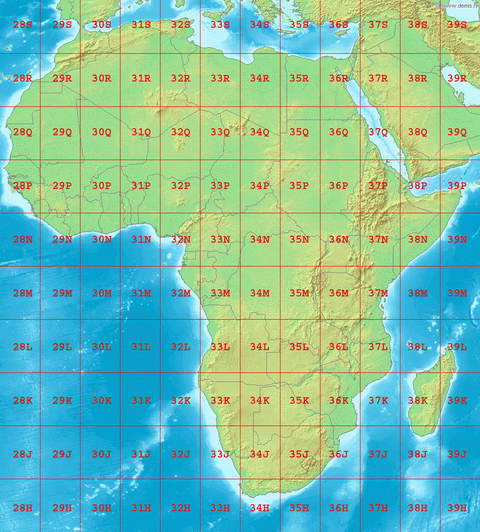
Map of Africa, showing the latitude and longitude zones of the en:Universal Transverse Mercator coordinate system, from 28H to 39S.
Bounding box West -18°, South -40°, East 54°, North 40°. Center at 0°00′00″N 18°00′00″E / 0.00000°N 18.00000°E.
This image is in the public domain because it came from the site https://www.demis.nl/products/web-map-server/examples/ and was released by the copyright holder. Permission is granted to copy, distribute and/or modify this map since it is based on free of copyright images from: www.demis.nl. See also approval email on de.wp and its clarification.
|
| This work has been released into the public domain by its copyright holder, www.demis.nl. This applies worldwide. I nogle lande er dette ikke juridisk muligt. I så fald: www.demis.nl giver enhver ret til at anvende dette værk til ethvert formål, uden nogen restriktioner, medmindre sådanne restriktioner er påkrævede ved lov.
|
Filhistorik
Klik på en dato/tid for at se filen som den så ud på det tidspunkt.
| Dato/tid | Miniaturebillede | Dimensioner | Bruger | Kommentar | |
|---|---|---|---|---|---|
| nuværende | 3. sep. 2006, 04:32 | | 948 × 1.050 (225 KB) | LA2 | Map of Africa, showing the latitude and longitude zones of the en:Universal Transverse Mercator coordinate system, from 28H to 39S. Bounding box West -18°, South -40°, East 54°, North 40°. Center at ((coor d|0.00000|S|18.00000|E|scale:48000000)) |
Filanvendelse
Den følgende side bruger denne fil:
Global filanvendelse
Følgende andre wikier anvender denne fil:
- Anvendelser på ar.wikipedia.org
- Anvendelser på de.wikipedia.org
- Anvendelser på en.wikipedia.org
- Anvendelser på fa.wikipedia.org
- Anvendelser på hu.wikipedia.org
- Anvendelser på nl.wikipedia.org
- Anvendelser på no.wikipedia.org
- Anvendelser på pl.wikipedia.org
- Anvendelser på sr.wikipedia.org
- Anvendelser på th.wikipedia.org
Metadata
Text is available under the CC BY-SA 4.0 license; additional terms may apply.
Images, videos and audio are available under their respective licenses.
Cover photo is available under {{::mainImage.info.license.name || 'Unknown'}} license.
Cover photo is available under {{::mainImage.info.license.name || 'Unknown'}} license.
Credit:
(see original file).
