For faster navigation, this Iframe is preloading the Wikiwand page for Òbrôzk:Angola carte.png.

Òbrôzk:Angola carte.png

Angola_carte.png(330 × 355 pikslów, miara lopka: 29 KB, ôrt MIME: image/png)

Nen lopk je w Wikimedia Commons ë mòże bëc brëkòwóny w jinnych ùdbach. Niżi je wëdowiédzô ze starnë òpisënkù negò lopka.

Òpisënk

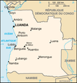
Òpisënk Map in French of Angola
Datum translation : August 2006
Zdrój CIA World Factbook
Aùtor of the translation : Eric Gaba (Sting)
Przistãp
(Ùżëcé znowa negò lopka)
PD
Inne wersje

Derivative works of this file:

original English version : Image:Angola_map.png


Français : * Sujet : Carte en français de l'Angola ;

Licencëjô

Public domain
Ten obrazek należy do domeny publicznej, bo zawiera materiały pochodzące z World Factbook należącej do amerykańskiej Centralnej Agencji Wywiadowczej (CIA).

Bahasa Indonesia  čeština  Deutsch  eesti  English  español  Esperanto  français  galego  hrvatski  italiano  Nederlands  norsk nynorsk  polski  português  sicilianu  slovenščina  suomi  Türkçe  Zazaki  беларуская (тарашкевіца)  македонски  русский  српски / srpski  українська  ქართული  বাংলা  தமிழ்  മലയാളം  한국어  日本語  中文  中文(简体)  中文(繁體)  العربية  +/−


Public domain This work was previously under Public Domain, or a Free License. It has been digitally enhanced and/or modified. This derivative work has been (or is hereby) released into the public domain by its author, Sting at the French Wikipedia project. This applies worldwide.

In some countries this is not legally possible; if so:
Sting grants anyone the right to use this work for any purpose, without any conditions, unless such conditions are required by law.


English  简体中文‎  繁體中文‎  +/−

Podpisy

Dodaj jednolinijkowe objaśnienie tego, co ten plik pokazuje

Obiekty przedstawione na tym zdjęciu

przedstawia polski

typ MIME polski

image/png

bb383db0554459ce8640dc08536e92351ea88790

metoda określenia polski: SHA-1 polski

29 574 bajt

wysokość polski

355 piksel

szerokość polski

330 piksel

Historëjô lopka

Klëkni na datum/czas, abë òbaczëc jak wëzdrzôł lopk w tim czasu.

Datum/CzasMiniaturaMiaraBrëkòwnikÒpisënk
aktualny22:06, 30 zél 2006Miniatura wersëji z 22:06, 30 zél 2006330 × 355 (29 KB)Sting((Information |Description=Map in French of Angola |Source=[http://www.cia.gov/cia/publications/factbook/ CIA World Factbook] |Date=translation : August 2006 |Author=of the translation : Eric Gaba (Sting) |Permission=PD |other_versions=orig

Lënczi do lopka

Hewò są starnë, jaczé òdwòłëją sã do negò lopka:

Globalné wëzwëskanié lopka

Nene lopk je téż brëkòwnóny w jinnych ùdbach Wiki:

{{bottomLinkPreText}} {{bottomLinkText}}
Òbrôzk:Angola carte.png
Listen to this article

This browser is not supported by Wikiwand :(
Wikiwand requires a browser with modern capabilities in order to provide you with the best reading experience.
Please download and use one of the following browsers:

This article was just edited, click to reload
This article has been deleted on Wikipedia (Why?)

Back to homepage

Please click Add in the dialog above
Please click Allow in the top-left corner,
then click Install Now in the dialog
Please click Open in the download dialog,
then click Install
Please click the "Downloads" icon in the Safari toolbar, open the first download in the list,
then click Install
{{::$root.activation.text}}

Install Wikiwand

Install on Chrome Install on Firefox
Don't forget to rate us

Tell your friends about Wikiwand!

Gmail Facebook Twitter Link

Enjoying Wikiwand?

Tell your friends and spread the love:
Share on Gmail Share on Facebook Share on Twitter Share on Buffer

Our magic isn't perfect

You can help our automatic cover photo selection by reporting an unsuitable photo.

This photo is visually disturbing This photo is not a good choice

Thank you for helping!


Your input will affect cover photo selection, along with input from other users.

X

Get ready for Wikiwand 2.0 🎉! the new version arrives on September 1st! Don't want to wait?