Payl:Mali Mopti.png
Walay mas taas nga resolusyon.
Mali_Mopti.png (449 × 443 pixels, size sa payl: 5 KB, MIME type: image/png)
Mubong sugid:
| Deskripsyon |
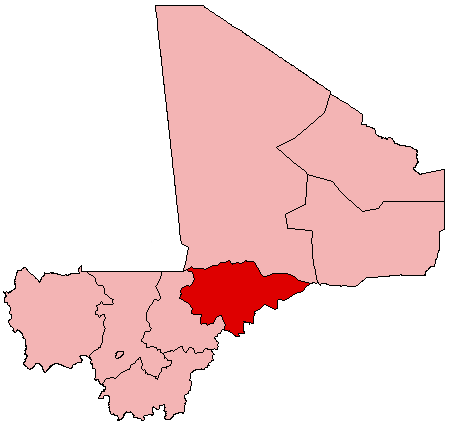
English: Map of Mali showing Mopti Region; created with the GIMP. Made by User:Acntx. |
| Petsa | 31 Hulyo 2005 (original upload date) |
| Gigikanan | Kaugalingong trabaho |
| Tagsulat | Acntx at English Wikipedya |
Pagtugot
Acntx at English Wikipedya, the copyright holder of this work, hereby publishes it under the following license:
| This file is licensed under the Creative Commons Attribution-Share Alike 3.0 Unported license. Subject to disclaimers. | ||
| Attribution: Acntx at English Wikipedya | ||
| ||
| This licensing tag was added to this file as part of the GFDL licensing update. |

|
Gitugot ang pagkopya, pag-apud-apod o/ug pag-usab ning maong dokumento ubos sa mga termino sa GNU Free Documentation License, Version 1.2 o mas bag-ong bersiyon nga gimantala sa Free Software Foundation; nga walay Invariant Sections, walay Front-Cover Texts, ug walay Back-Cover Texts. Ang kopya sa lisensiya gilakip sa bahin nga giulohang GNU Free Documentation License. Subject to disclaimers. |
Original upload log
The original description page was here. All following user names refer to en.wikipedia.
- 2005-07-31 21:23 Acntx 449×443 (5344 bytes)
Kaagi sa payl
I-klik ang petsa/oras aron makit-an ang hulagway sa payl niadtong panahona.
| Petsa/Takna | Thumbnail | Mga dimensyon | Tiggamit | Komento | |
|---|---|---|---|---|---|
| kasamtangan | 19:54, 12 Hulyo 2012 | | 449 × 443 (5 KB) | MGA73bot2 | ((BotMoveToCommons|en.wikipedia|year=((subst:CURRENTYEAR))|month=((subst:CURRENTMONTHNAME))|day=((subst:CURRENTDAY)))) == ((int:filedesc)) == ((Information |description=((en|1=Map of Mali showing Mopti Region; created with the GIMP. Made by [[:en:User... |
Mga paggamit sa payl
Ang mosunod nga mga panid misumpay niining payl:
Global nga paggamit sa payl
Kining ubang wiki naggamit ning maong payl:
- Paggamit sa ar.wikipedia.org
- Paggamit sa bg.wikipedia.org
- Paggamit sa en.wikipedia.org
- Djenné
- Mopti Region
- Mopti
- Hombori
- Bandiagara
- Banani, Mali
- Mount Hombori
- Bankass
- Sévaré
- Kumara (Mali)
- Ténenkou Cercle
- Douentza Airport
- Douentza
- Wikipedia:WikiProject Mali/Regional commune templates
- Template:Communes of the Mopti Region
- Bandiagara Cercle
- Bankass Cercle
- Djenné Cercle
- Douentza Cercle
- Koro Cercle
- Mopti Cercle
- Youwarou Cercle
- Guimini
- Diafarabé
- Kani-Kombole
- Template:Mopti-geo-stub
- Doucoumbo
- Dourou
- Dogani Béré
- Kendé, Mali
- Pelou
- Soroly
- Dandoli
- Borko, Mali
- Ondougou
- Kendié
- Baye, Mopti
- Socoura
- Dialloubé
- Fatoma
- Konna
- Ouro Modi
- Soye, Mali
- Koubaye
- Bassirou
- Korombana
- Kounari
- Ouroubé Douddé
View more global usage of this file.
Metadata
Text is available under the CC BY-SA 4.0 license; additional terms may apply.
Images, videos and audio are available under their respective licenses.
Cover photo is available under {{::mainImage.info.license.name || 'Unknown'}} license.
Cover photo is available under {{::mainImage.info.license.name || 'Unknown'}} license.
Credit:
(see original file).
