Regions de Namíbia
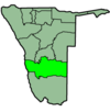
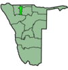
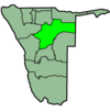
 La república de Namíbia es divideix, des de la proclamació d'independència de l'any 1990, en 13 regions (nom oficial en anglès: Regions of Namibia) administratives que es corresponen a regions de tipus geogràfic o històrico-culturals. La capital de Namíbia és Windhoek. Totes les regions i les capitals corresponents es poden veure en aquesta taula:
| Núm. | Nom | Superfície en km² | Núm. per superfície | Població | Capital |
|---|---|---|---|---|---|
| 1 | Caprivi | 19.532 | 10 | 79.852 | Katima Mulilo |
| 2 | Erongo | 63.586 | 6 | 107.629 | Swakopmund |
| 3 | Hardap | 109.888 | 3 | 67.998 | Mariental |
| 4 | Karas | 161.325 | 1 | 69.677 | Keetmanshoop |
| 5 | Kavango | 43.418 | 7 | 201.093 | Rundu |
| 6 | Khomas | 36.805 | 8 | 250.305 | Windhoek |
| 7 | Kunene | 144.255 | 2 | 68.244 | Opuwo |
| 8 | Ohangwena | 10.582 | 12 | 227.728 | Oshikango |
| 9 | Omaheke | 84.732 | 5 | 67.496 | Gobabis |
| 10 | Omusati | 13.638 | 11 | 228.364 | Outapi |
| 11 | Oshana | 5.290 | 13 | 192.000 | Oshakati |
| 12 | Oshikoto | 26.607 | 9 | 160.788 | Tsumeb |
| 13 | Otjozondjupa | 105.328 | 4 | 135.723 | Otjiwarongo |
Sovint es parla de les regions del sud, del centre oest, del centre est, del nord i del nord-est en dividir el país en regions tipogràfiques i geogràfiques en funció del lloc on es troben. Cadascuna de les 13 regions es divideix alhora en districtes electorals. Aquests districtes, de la mateixa manera que les regions, es formen a partir de diferències històrico-culturals existents. Aquest fet fa que el nombre i la mida dels districtes sigui molt desigual entre les diferents regions.
Namíbia consta de 102 districtes electorals en total. Cadascun d'aquests districtes elegeix un membre del Consell Regional de la regió a la qual pertany. Hi ha 13 Consells Regionals sense que cap zona del país es trobi dins d'un règim especial. Els districtes més habitats del país són Hakanana i Katutura, dins de l'àrea metropolitana de Windhoek, mentre el menys habitat és el districte d'Okatjali, a la regió d'Oshana. Val a dir que, en alguns casos, un mateix districte es dividí en dos, fent que la zona urbana i rural formessin dos districtes diferents.
A continuació teniu un llista de tots els districtes electorals de Namíbia ordenats per regions:
Caprivi
[modifica]- Kabbe
- Katima Mulilo (ciutat)
- Katima Mulilo (districte)
- Kongola
- Linyanti
- Sibinda
Erongo
[modifica]- Arandis
- Brandberg
- Karibib
- Omaruru
- Swakopmund
- Walfischbucht (ciutat)
- Walfischbucht (districte)
Hardap
[modifica]- Gibeon
- Maltahöhe
- Mariental (ciutat)
- Mariental (districte)
- Rehoboth (districte)
- Rehoboth Est (ciutat)
- Rehoboth Oest (ciutat)
Karas
[modifica]- Berseba
- Karasburg
- Keetmanshoop (ciutat)
- Keetmanshoop (districte)
- Lüderitz
- Oranjemund
Kavango
[modifica]- Kahenge
- Kapako
- Marshare
- Mpungu
- Mukwe
- Ndiyona
- Rundu (ciutat)
- Rundu (districte)
Khomas
[modifica]- Hakahana
- Katutura Est
- Khomasdal
- Kututura
- Soweto
- Waneheda
- Windhoek (districte)
- Windhoek Est (ciutat)
- Windhoek Oest (ciutat)
Kunene
[modifica]- Epupa
- Kamanjab
- Khorixas
- Opuwo
- Outjo
- Sesfontein
Ohangwena
[modifica]- Eenhana
- Endola
- Engela
- Epembe
- Ohangwena (districte)
- Okongo
- Omundaungila
- Ondobe
- Ongenga
- Oshikango
Omaheke
[modifica]- Aminuis
- Gobabis
- Kalahari
- Otjombinde
- Steinhausen
Omusati
[modifica]- Anamulenge
- Elim
- Ogongo
- Okahao
- Okalongo
- Oshikuku
- Outapi
- Ruacana
- Tsandi
Oshana
[modifica]- Okatana
- Okatjali
- Okatu
- Ompundja
- Ondangwa
- Ongwediva
- Oshakati
- Uukwiyu
- Uuvudhiya
Oshikoto
[modifica]- Engodi
- Guinas
- Oniipai
- Okangolo
- Okatope
- Olukonda
- Omuntele
- Omuthiygwiipundi
- Onayena
- Oshikoto (districte)
- Otavi
- Tsumeb
Otjozondjupa
[modifica]- Grootfontein
- Okahandja
- Okakarara
- Omatak
- Otavi
- Otjiwarongo
Vegeu també
[modifica]- ISO 3166-2:NA
Enllaços externs
[modifica]Text is available under the CC BY-SA 4.0 license; additional terms may apply.
Images, videos and audio are available under their respective licenses.


