For faster navigation, this Iframe is preloading the Wikiwand page for Regió de Hinterrhein.

Regió de Hinterrhein

Aquest article o secció no cita les fonts o necessita més referències per a la seva verificabilitat.
Plantilla:Infotaula geografia políticaRegió de Hinterrhein

Localització
lang=ca Modifica el valor a Wikidata Map
 46° 35′ 09″ N, 9° 25′ 34″ E / 46.58572°N,9.42617°E / 46.58572; 9.42617
Estat federatSuïssa
CantóGrisons Modifica el valor a Wikidata
CapitalThusis Modifica el valor a Wikidata
Conté la subdivisió
Avers (en) Tradueix
Domleschg (en) Tradueix
Rheinwald (en) Tradueix
Schams (en) Tradueix
Thusis (en) Tradueix Modifica el valor a Wikidata
Geografia
Superfície617,63 km² Modifica el valor a Wikidata
Altitud1.987 m Modifica el valor a Wikidata
Identificador descriptiu
Fus horari

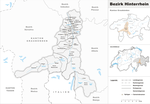
La Regió de Hinterrhein és una de les 11 regions del cantó dels Grisons (Suïssa). És una regió bilingüe amb l'alemany i el romanx com a llengua oficial i està formada per 38 municipis repartits en 5 cercles comunals. Té una població de 12415 habitants (cens de 2007) i una superfície de 617,63 km². El cap de la regió és Hinterrhein.

Municipis

[modifica]
Cercle d'Avers
Escut Nom Població
(Des. 2007)
Superfície
in km²
Núm. OFS
Avers Avers 170 93.12
Cercle de Domleschg
Escut Nom Població
(Des. 2007)
Superfície
in km²
Núm. OFS
Almens Almens 221 8.34
Fürstenau Fürstenau 332 1.32
Paspels Paspels 454 4.59
Pratval Pratval 234 0.77
Rodels Rodels 264 1.68
Rothenbrunnen Rothenbrunnen 303 3.11
Scharans Scharans 818 14.29
Sils im Domleschg Sils im Domleschg 842 9.28
Tomils Tomils 709 30.56
Cercle de Rheinwald
Escut Nom Població
(Des. 2007)
Superfície
in km²
Núm. OFS
Hinterrhein Hinterrhein 78 48.30
Nufenen Nufenen 151 28.03
Splügen Splügen 421 60.49
Sufers Sufers 127 34.62
Cercle de Schams
Escut Nom Població
(Des. 2007)
Superfície
in km²
Núm. OFS
Andeer Andeer 881 46.30
Casti-Wergenstein Casti-Wergenstein 60 25.62
Donat Donat 221 4.67
Ferrera Ferrera 84 75.46
Lohn Lohn 50 8.17
Mathon Mathon 55 15.13
Rongellen Rongellen 45 2.02
Zillis-Reischen Zillis-Reischen 397 24.48
Cercle de Thusis
Escut Nom Població
(Des. 2007)
Superfície
in km²
Núm. OFS
Cazis Cazis 1503 7.26
Flerden Flerden 204 6.09
Masein Masein 394 4.20
Portein Portein 22 3.42
Präz Präz 161 11.35
Sarn Sarn 142 7.60
Tartar Tartar 168 1.55
Thusis Thusis 2633 6.81
Tschappina Tschappina 162 24.67
Urmein Urmein 109 4.33


Vegeu també

[modifica]
{{bottomLinkPreText}} {{bottomLinkText}}
Regió de Hinterrhein
Listen to this article

This browser is not supported by Wikiwand :(
Wikiwand requires a browser with modern capabilities in order to provide you with the best reading experience.
Please download and use one of the following browsers:

This article was just edited, click to reload
This article has been deleted on Wikipedia (Why?)

Back to homepage

Please click Add in the dialog above
Please click Allow in the top-left corner,
then click Install Now in the dialog
Please click Open in the download dialog,
then click Install
Please click the "Downloads" icon in the Safari toolbar, open the first download in the list,
then click Install
{{::$root.activation.text}}

Install Wikiwand

Install on Chrome Install on Firefox
Don't forget to rate us

Tell your friends about Wikiwand!

Gmail Facebook Twitter Link

Enjoying Wikiwand?

Tell your friends and spread the love:
Share on Gmail Share on Facebook Share on Twitter Share on Buffer

Our magic isn't perfect

You can help our automatic cover photo selection by reporting an unsuitable photo.

This photo is visually disturbing This photo is not a good choice

Thank you for helping!


Your input will affect cover photo selection, along with input from other users.

X

Get ready for Wikiwand 2.0 🎉! the new version arrives on September 1st! Don't want to wait?