Illa de Ross
| Ross Island (en) | ||||
| Epònim | James Clark Ross | |||
|---|---|---|---|---|
| Localització | ||||
| ||||
| Territori reivindicat per | Nova Zelanda | |||
| Condomini | Regió Antàrtica | |||
| Població humana | ||||
| Població | 263 | |||
| Geografia | ||||
| Part de | ||||
| Superfície | 2.460 km² | |||
| Mesura | 75 ( | |||
| Banyat per | oceà Antàrtic | |||
| Altitud | 3.794 m | |||
| Punt més alt | Mont Erebus (3.794 m) | |||
| Identificador descriptiu | ||||
| Fus horari | ||||

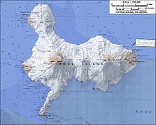
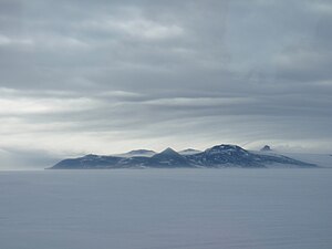
L'Illa Ross està formada per tres volcans en el mar de Ross a l'Antàrtida,[1] davant de la costa de la terra Victòria a l'estret McMurdo.[2] La seva àrea és de 2.460 quilòmetres quadrats. Tant sol una petita part de l'illa està lliure de gel i neu.
Història
[modifica]Sir James Clark Ross la va descobrir en 1841,[3] i va ser posteriorment nomenada així en el seu honor per Robert Falcon Scott. Allotja el volcà dorment Mont Terror, de 3.230 metres d'altitud, i el Mont Erebus, de 3.794, són els volcans actius més australs de la Terra. Ambdós van ser nomenats per Ross pels noms dels seus vaixells. La tercera major elevació és el Muntanya Byrd, nomenat per l'explorador estatunidenc Richard E. Byrd.[4]
L'illa és reclamada per Nova Zelanda com a part de la Dependència Ross, però aquesta reclamació és en suspens en virtut del Tractat Antàrtic.[5]
Referències
[modifica]- ↑ Hogan, C Michael. «Ross Sea». The Encyclopedia of Earth, May 5, 2013. [Consulta: 4 agost 2024].
- ↑ «Ross Island, Antarctica». geographic.org. [Consulta: 4 agost 2024].
- ↑ Alberts, Fred G. Geographic Names of the Antarctic. United States Board on Geographic Names, 1995, p. 63º.
- ↑ Hjort, Christian; Ingólfsson, Ólafur; Möller, Per; Lirio, Juan Manuel «Holocene glacial history and sea-level changes on James Ross Island, Antarctic Peninsula» (en anglès). Journal of Quaternary Science, 12, 4, 1997-07, pàg. 259–273. DOI: 10.1002/(SICI)1099-1417(199707/08)12:4<259::AID-JQS307>3.0.CO;2-6.
- ↑ Alley, Roderic «New Zealand and Antarctica» (en anglès). International Journal: Canada's Journal of Global Policy Analysis, 39, 4, 1984-12, pàg. 911–931. DOI: 10.1177/002070208403900408. ISSN: 0020-7020.
Text is available under the CC BY-SA 4.0 license; additional terms may apply.
Images, videos and audio are available under their respective licenses.


