Fitxer:International E Road Network green.png
Mida d'aquesta previsualització: 800 × 571 píxels. Altres resolucions: 320 × 229 píxels | 640 × 457 píxels.
Fitxer original (840 × 600 píxels, mida del fitxer: 38 Ko, tipus MIME: image/png)
| Aquest fitxer i la informació mostrada a continuació provenen del dipòsit multimèdia lliure Wikimedia Commons. |

|
Aquesta imatge (de tipus road map) s'hauria de tornar a crear utilitzant gràfics vectorials com ara un fitxer SVG. Això té diversos avantatges; en trobareu més informació a Commons:Media for cleanup. Si ja disposeu d'una versió d'aquesta imatge en format SVG, us preguem que la pengeu; després, reemplaceu aquesta plantilla amb la plantilla ((Vector version available|nom nou de la imatge.svg)) en aquesta imatge.
|
Resum
| Descripció |
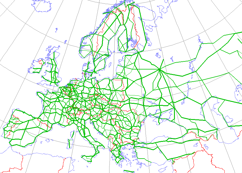
English: Map generated using coastline/boundary data from World Data Bank, and locations from http://www.world-gazetteer.com/. Straight lines connect control cities, no attempt to follow the real road. Roads color has been changed to green.
Deutsch: Diese Karte wurde mit den Küsten- und Grenzverlaufsdaten aus der World Data Bank und mit den Koordinaten aus http://www.world-gazetteer.com/ erstellt. Die Städte sind durch gerade Linien vebunden die nicht unbedingt den realen Straßenverlauf wiedergeben. Die Farbe der Straßen wurde in grün geändert.
Türkçe: Harita oluşturulken sahilyolu ve sınırlar bilgisi Dünya Bilgi Bankası'ndan ve lokasyonlar http://www.world-gazetteer.com/ adlı siteden alınmıştır. Düz çizgiler kontrol şehirlerini bağlar. Yol rengi yeşile değiştirildi. |
| Font | http://en.wikipedia.org/wiki/Image:International_E_Road_Network.png |
| Autor | Kjhskj75 |
Llicència
| Jo, el titular del copyright d'aquesta obra, l'allibero al domini públic. Això s'aplica a tot el món. En alguns països això pot no ser legalment possible, en tal cas: Jo faig concessió a tothom del dret d'usar aquesta obra per a qualsevol propòsit, sense cap condició llevat d'aquelles requerides per la llei. |
Historial del fitxer
Cliqueu una data/hora per veure el fitxer tal com era aleshores.
| Data/hora | Miniatura | Dimensions | Usuari/a | Comentari | |
|---|---|---|---|---|---|
| actual | 18:09, 13 maig 2008 | | 840 × 600 (38 Ko) | Jklamo | Albania update |
| 14:07, 22 des 2007 |  | 840 × 600 (39 Ko) | BIL | == Description == ((Information |Description=Map generated using coastline/boundary data from World Data Bank, and locations from www.world-gazetteer.com. Straight lines connect control cities, no attempt to follow the real road. Roads color has been chan | |
| 22:03, 7 oct 2007 |  | 840 × 600 (33 Ko) | The RedBurn | All e-roads in green. | |
| 21:55, 7 oct 2007 |  | 840 × 600 (34 Ko) | The RedBurn | ((Information |Description=Map generated using coastline/boundary data from World Data Bank, and locations from www.world-gazetteer.com. Straight lines connect control cities, no attempt to follow the real road. Roads color has been changed to green. |Sou |
Ús del fitxer
Hi ha més de 100 pàgines que utilitzen aquest fitxer. La següent llista només mostra les primeres 100 d'aquestes pàgines que utilitzen aquest fitxer. Podeu consultar la llista completa.
- Carretera europea E01
- E03
- E04
- E05
- E09
- E101
- E105
- E11
- E115
- E117
- E12
- E13
- E14
- E15
- E16
- E17
- E18
- E19
- E20
- E21
- E22
- E23
- E24
- E25
- E26
- E27
- E28
- E29
- E30
- E31
- E32
- E33
- E34
- E35
- E36
- E37
- E38
- E39
- E40
- E41
- E42
- E43
- E44
- E45
- E46
- E47
- E48
- E49
- E50
- E51
- E52
- E53
- E54
- E55
- E56
- E57
- E58
- E59
- E60
- E61
- E62
- E63
- E64
- E65
- E66
- E67
- E68
- E69
- E70
- E71
- E72
- E73
- E74
- E75
- E76
- E77
- E78
- E79
- E80
- E81
- E82
- E83
- E84
- E85
- E86
- E87
- E88
- E89
- E90
- E903
- E91
- E92
- E93
- E94
- E95
- E96
- E97
- E98
- E99
- Llista de carreteres europees de classe A
Visualitza més enllaços que porten al fitxer.
Ús global del fitxer
Utilització d'aquest fitxer en altres wikis:
- Utilització a ar.wikipedia.org
- Utilització a be.wikipedia.org
- Utilització a bg.wikipedia.org
- Европейски път
- Европейски път Е79
- Европейски път Е70
- Европейски път Е80
- Европейски път Е67
- Европейски път Е85
- Европейски път Е851
- Европейски път Е671
- Шаблон:Европейска пътна мрежа
- Европейски път Е81
- Европейски път Е804
- Европейски път Е763
- Европейски път Е762
- Европейски път Е87
- Европейски път Е772
- Европейски път Е83
- Европейски път Е871
- Европейски път Е75
- Европейски път Е773
- Европейски път Е11
- Европейски път Е51
- Европейски път Е761
- Европейски път Е17
- Европейски път Е76
- Европейски път Е82
- Европейски път Е84
- Европейски път Е86
- Европейски път E01
- Европейски път E03
- Европейски път E04
- Европейски път E05
- Европейски път E06
- Европейски път E07
- Европейски път E08
- Европейски път E09
- Европейски път E10
- Европейски път E12
- Европейски път E13
- Европейски път E14
- Европейски път E15
Vegeu més usos globals d'aquest fitxer.
Metadades
Text is available under the CC BY-SA 4.0 license; additional terms may apply.
Images, videos and audio are available under their respective licenses.
Cover photo is available under {{::mainImage.info.license.name || 'Unknown'}} license.
Cover photo is available under {{::mainImage.info.license.name || 'Unknown'}} license.
Credit:
(see original file).
