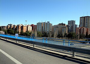
Costillares
| Sobrenom | Pinar de Chamartín | ||||
|---|---|---|---|---|---|
| Localització | |||||
| |||||
| Estat | Espanya | ||||
| Comunitat autònoma | Comunitat de Madrid | ||||
| Municipi | Madrid | ||||
| Districte | Ciudad Lineal | ||||
| Població humana | |||||
| Població | 22.093 (2018) | ||||
| Geografia | |||||
| Superfície | 1,427052 km² | ||||
| Altitud | 620 m | ||||
| Limita amb | |||||
Costillares és un barri del districte de Ciudad Lineal, a Madrid, més conegut popularment com a Pinar de Chamartín. Té una superfície de 142,72 hectàrees i una població de 23.028 habitants (2009). Limita al nord amb el barri de Valdefuentes, al sud amb Atalaya, a l'est amb Pinar del Rey i Apóstol Santiago (Hortaleza) i a l'oest amb Castilla (Chamartín). Els seus carrers principals són la part final d'Arturo Soria, Jazmín i Caleruega.
Geografia
[modifica]
El barri comprèn la zona coneguda com a Pinar de Chamartín, la zona més alta del municipi de Madrid. En el tall del carrer d'Arturo Soria i l'avinguda de San Luis, el terreny aconsegueix una altura de 742. A més, en aquest punt se situa un edifici de 21 plantes de 80 metres d'altura, amb el que l'altura final (comptant l'edifici) és de 820 metres. No obstant això no és el punt més alt en edifici, ja que la Torre Picasso té una altura total de 860 metres. La població del barri és de 22.616 habitants i el grup d'edat més representat són els habitants entre 25 i 29 anys.
Transports
[modifica]El barri es troba molt ben connectat amb Hortaleza i les zones nord i centre de Madrid per les línies d'autobusos:
- 107 i 129 connecten el barri amb Plaça de Castilla.
- 150 connecta amb Virgen del Cortijo i la Puerta del Sol
- 125 connecta amb Mar de Cristal i l'Hospital Ramón y Cajal
- 7 connecta Manoteras amb la Plaza d'Alonso Martínez
- 29 connecta Manoteras amb l'Avinguda de Felipe II
- N1, de recorregut nocturn
El Metro de Madrid disposa de dues estacions al barri:

 L'11 d'abril de 2007 la línia 1 i la línia 4 s'ampliaren fins a arribar a la nova estació de Pinar de Chamartín.
- Alhora la línia ML1 del Metro Ligero, que va als PAUs de Sanchinarro i Las Tablas passant per Isla de Chamartín i Virgen del Cortijo, hi té una estació.
Enllaços externs
[modifica]- Ortofoto del districte amb els límits de cada barri
- Districtes de Madrid
- Barrio de Costillares Arxivat 2012-10-12 a Wayback Machine. a Madripedia, amb llicència GNU.
Districtes i barris de Madrid | ||||||||||||||||||||||||||||||||||||||||||||||||
|---|---|---|---|---|---|---|---|---|---|---|---|---|---|---|---|---|---|---|---|---|---|---|---|---|---|---|---|---|---|---|---|---|---|---|---|---|---|---|---|---|---|---|---|---|---|---|---|---|
Centro · Arganzuela · Retiro · Salamanca · Chamartín · Tetuán · Chamberí · Fuencarral-El Pardo · Moncloa-Aravaca · Latina · Carabanchel · Usera · Puente de Vallecas · Moratalaz · Ciudad Lineal · Hortaleza · Villaverde · Villa de Vallecas · Vicálvaro · San Blas-Canillejas · Barajas | ||||||||||||||||||||||||||||||||||||||||||||||||
| ||||||||||||||||||||||||||||||||||||||||||||||||
Text is available under the CC BY-SA 4.0 license; additional terms may apply.
Images, videos and audio are available under their respective licenses.


