মডিউল:অবস্থান মানচিত্র/উপাত্ত/পৃথিবী
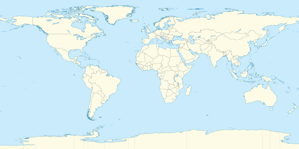
বিশ্বের মানচিত্রে পৃথিবীর অবস্থান।
|
| নাম | পৃথিবী | |||
|---|---|---|---|---|
| সীমানার স্থানাঙ্ক | ||||
| 90 | ||||
| -180 | ←↕→ | 180 | ||
| -90 | ||||
| মানচিত্রের কেন্দ্র | ০° উত্তর ০° পূর্ব / ০° উত্তর ০° পূর্ব | |||
| চিত্র | World location map (equirectangular 180).svg | |||
.svg)
| ||||
| চিত্র১ | World location map (equirectangular 180).svg | |||
|
| ||||
মডিউল:অবস্থান মানচিত্র/উপাত্ত/পৃথিবী একটি অবস্থান মানচিত্রের সংজ্ঞা যা পৃথিবী-এর সমদূরবর্তী নলাকার অভিক্ষেপ মানচিত্রে আস্তরণ চিহ্নিত এবং লেবেল করতে ব্যবহৃত হয়। চিহ্নিতকারী পূর্বনির্ধারিত মানচিত্র বা একটি অনুরূপ চিত্র মানচিত্রের অক্ষাংশ এবং দ্রাঘিমাংশের স্থানাঙ্ক অনুযায়ী স্থাপিত হয়।
ব্যবহার
এই সংজ্ঞাটি নিম্নলিখিত টেমপ্লেটে ব্যবহৃত হয় যখন তা "পৃথিবী" প্যারামিটার দিয়ে ডাকা হবে:
((অবস্থান মানচিত্র | পৃথিবী | ...))((অবস্থান মানচিত্র বহু | পৃথিবী | ...))((অবস্থান মানচিত্র+ | পৃথিবী | ...))((অবস্থান মানচিত্র~ | পৃথিবী | ...))
মানচিত্রের সংজ্ঞা
নাম = পৃথিবী- পূর্বনির্ধারিত মানচিত্রের ক্যাপশনে ব্যবহৃত নাম
চিত্র = World location map (equirectangular 180).svg- পূর্বনির্ধারিত মানচিত্রের চিত্র, "Image:" বা "File:" বা "চিত্র" ছাড়া
চিত্র১ = World location map (equirectangular 180).svg- একটি বিকল্প মানচিত্রের চিত্র, সাধারণত একটি রিলিফ মানচিত্র, যা relief বা AlternativeMap প্যারামিটার ব্যবহার করে প্রদর্শন করানো যাবে
উপর = 90- দশমিক ডিগ্রীতে, মানচিত্রের উপরের প্রান্তের অক্ষাংশ
নীচ = -90- দশমিক ডিগ্রীতে, মানচিত্রের নিচের প্রান্তের অক্ষাংশ
বাম = -180- দশমিক ডিগ্রীতে, মানচিত্রের বাম প্রান্তের দ্রাঘিমাংশ
ডান = 180- দশমিক ডিগ্রীতে, মানচিত্রের ডান প্রান্তের দ্রাঘিমাংশ
বিকল্প মানচিত্র
((অবস্থান মানচিত্র)), ((অবস্থান মানচিত্র বহু)), এবং ((অবস্থান মানচিত্র+)) টেমপ্লেটগুলিতে একটি বিকল্প মানচিত্র চিত্র নির্দিষ্ট করার জন্য প্যারামিটার রয়েছে। চিত্র১ হিসাবে প্রদর্শিত মানচিত্রটি relief বা AlternativeMap প্যারামিটারগুলির সাথে ব্যবহার করা যেতে পারে। উদাহরণ নীচের বা নিম্নলিখিত পাওয়া যেতে পারে:
- টেমপ্লেট:অবস্থান মানচিত্র#ত্রাণ প্যারামিটার
- টেমপ্লেট:অবস্থান মানচিত্র+/রিলীফ
- টেমপ্লেট:অবস্থান মানচিত্র#বিকল্প মানচিত্র প্যারামিটার
- টেমপ্লেট:অবস্থান মানচিত্র+/বিকল্প মানচিত্র
নির্ভুলতা
দ্রাঘিমাংশ: পশ্চিম থেকে পূর্বে এই মানচিত্রের সংজ্ঞা 0 ডিগ্রী কভার করে।
- ২০০ পিক্সেল প্রস্থের একটি চিত্রে, সেটি হচ্ছে পিক্সেল প্রতি 0 ডিগ্রী।
- ১০০০ পিক্সেল প্রস্থের একটি চিত্রে, সেটি হচ্ছে পিক্সেল প্রতি 0 ডিগ্রী।
অক্ষাংশ: উত্তর থেকে দক্ষিণে এই মানচিত্রের সংজ্ঞা 180 ডিগ্রী কভার করে।
- ২০০ পিক্সেল উচ্চতার একটি চিত্রে, সেটি হচ্ছে পিক্সেল প্রতি 0.9 ডিগ্রী।
- ১০০০ পিক্সেল উচ্চতার একটি চিত্রে, সেটি হচ্ছে পিক্সেল প্রতি 0.18 ডিগ্রী।
আরও দেখুন
অবস্থান মানচিত্র টেমপ্লেট
- টেমপ্লেট:অবস্থান মানচিত্র, একটি চিহ্ন এবং লেবেল প্রদর্শন করতে অক্ষাংশ ও দ্রাঘিমাংশ ব্যবহার করুন
- টেমপ্লেট:অবস্থান মানচিত্র বহু, এক সাথে নয়টির বেশি চিহ্ন এবং লেবেলে প্রদর্শন করতে
- টেমপ্লেট:অবস্থান মানচিত্র+, সীমাহীন সংখ্যক চিহ্ন এবং লেবেল প্রদর্শন করতে
নতুন মানচিত্র সংজ্ঞা তৈরি
Text is available under the CC BY-SA 4.0 license; additional terms may apply.
Images, videos and audio are available under their respective licenses.
