For faster navigation, this Iframe is preloading the Wikiwand page for चित्र:Uttar Pradesh administrative divisions.svg.

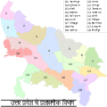
चित्र:Uttar Pradesh administrative divisions.svg

ओरिजनल फाइल(एसवीजी फाइल, नॉमिनली 1,500 x 1,500 पिक्सल, फाइल के आकार: 121 KB)

ई फाइल Wikimedia Commons से बा आ अउरी प्रोजेक्ट भी एकर इस्तेमाल कर सकत बाड़ें। एकर विवरण फाइल विवरण पन्ना नीचे देखावल गइल बा।

सारांश

बिबरण
English: This map has been created by Faiz Haider, it is based on Map of Uttar Pradesh on National Portal of India.
तारीख ७ फरवरी २००९ (original upload date)
स्रोत Transferred from en.wikipedia to Commons by Jeroen using CommonsHelper.
लेखक Faizhaider at अंगरेजी विकिपीडिया
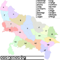
Other versions

[संपादन करीं]

लाइसेंसिंग

Public domain This work has been released into the public domain by its author, Faizhaider at अंगरेजी विकिपीडिया. This applies worldwide.
In some countries this may not be legally possible; if so:
Faizhaider grants anyone the right to use this work for any purpose, without any conditions, unless such conditions are required by law.
This image has been selected as a Selected picture at the Portal Uttar Pradesh on English Wikipedia.

Original upload log

The original description page was here. All following user names refer to en.wikipedia.
  • 2009-02-07 07:05 Faizhaider 1500×1500× (123417 bytes) This map has been created by [[User:Faizhaider|me]], it is based on [http://india.gov.in/maps/up.php Map of Uttar Pradesh on National Portal of India].

Captions

Add a one-line explanation of what this file represents
Uttar Pradesh administrative divisions

Items portrayed in this file

depicts अंगरेजी

inception अंगरेजी

७ फरवरी 2009

फाइल के इतिहास

ओ समय ई फाइल कइसन लउके ई देखे खातिर कौनों तारीख/समय पर क्लिक करीं।

तारीख/समयचिप्पी रूपडाइमेंशनप्रयोगकर्ताटिप्पणी
वर्तमान22:15, 30 जुलाई 200922:15, 30 जुलाई 2009 ले के संस्करण के चिप्पी रूप।1,500 × 1,500 (121 KB)File Upload Bot (Magnus Manske) ((BotMoveToCommons|en.wikipedia|year=((subst:CURRENTYEAR))|month=((subst:CURRENTMONTHNAME))|day=((subst:CURRENTDAY)))) ((Information |Description=((en|This map has been created by Faiz Haider, it is based on [http://india.gov.in/m

फाइल के उपयोग

फाइल के इस्तेमाल 2 पन्ना करत बाड़ें:

बैस्विक फाइल उपयोग

नीचे दिहल अउरी विकिसभ पर एह फाइल के इस्तेमाल हो रहल बा:

{{bottomLinkPreText}} {{bottomLinkText}}
चित्र:Uttar Pradesh administrative divisions.svg
Listen to this article

This browser is not supported by Wikiwand :(
Wikiwand requires a browser with modern capabilities in order to provide you with the best reading experience.
Please download and use one of the following browsers:

This article was just edited, click to reload
This article has been deleted on Wikipedia (Why?)

Back to homepage

Please click Add in the dialog above
Please click Allow in the top-left corner,
then click Install Now in the dialog
Please click Open in the download dialog,
then click Install
Please click the "Downloads" icon in the Safari toolbar, open the first download in the list,
then click Install
{{::$root.activation.text}}

Install Wikiwand

Install on Chrome Install on Firefox
Don't forget to rate us

Tell your friends about Wikiwand!

Gmail Facebook Twitter Link

Enjoying Wikiwand?

Tell your friends and spread the love:
Share on Gmail Share on Facebook Share on Twitter Share on Buffer

Our magic isn't perfect

You can help our automatic cover photo selection by reporting an unsuitable photo.

This photo is visually disturbing This photo is not a good choice

Thank you for helping!


Your input will affect cover photo selection, along with input from other users.

X

Get ready for Wikiwand 2.0 🎉! the new version arrives on September 1st! Don't want to wait?