Beziak Hermagor
Beziak Hermagor
| |
|---|---|
| Lage im Bundesland Kärnten | |
 | |
| Basisdaten | |
| Bundesland | Kärnten |
| NUTS-III-Region | AT-212 |
| Verwaltungssitz | Hermagor-Pressegger See |
| Fläche | 808 km2 |
| Einwohner | 18.051 (1. Jenna 2023) |
| Bevölkerungsdichte | 22 Einw./km² |
| Kfz-Kennzeichen | HE |
| Bezirkskennzahl | 203 |
| Bezirkshauptmannschaft | |
| Bezirkshauptmann | Heinz Pansi |
| Webseite | bh-hermagor.at |
Da Beziak Hermagor is a politischa Beziak vom östareichischn Bundesland Karntn.
Vawoitungsgliedarung
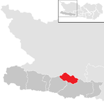
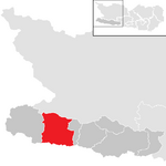
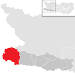
[Werkeln | Am Gwëntext werkeln]Da Beziak Hermagor gliedat si in siem Gmoana, drunta a Stod und zwoa Moaktgmoana. In Klomman stehn de Eihwohnazoihn vom 1. Jenna 2023.[1]

| Gmoa | slowenisch | Log | Einw. | Fläche | Ew/km² | Grichtsbeziak | Region | Typ | Metadaten |
|---|---|---|---|---|---|---|---|---|---|
Dellach
|
Dole |  46° 39′ 41″ N, 13° 4′ 46″ O |
1195 | 36,13 km² | 33 Ew/km² | Hermagor | Gailtal | Gemeinde | Gem.Kennz.: 20302 |
Gitschtal
|
Višprijska dolina |  46° 40′ 47″ N, 13° 15′ 38″ O |
1234 | 56,47 km² | 22 Ew/km² | Hermagor | Seitntoi vom Gailtal | Gemeinde | Gem.Kennz.: 20320 |
Hermagor-Pressegger See
|
Šmohor-Preseško jezero |  46° 37′ 38″ N, 13° 22′ 2″ O |
6951 | 205,36 km² | 34 Ew/km² | Hermagor | Gailtal | Stod- gmoa |
Gem.Kennz.: 20305 |
Kirchbach
|
Cirkno |  46° 38′ 28″ N, 13° 11′ 0″ O |
2492 | 99,07 km² | 25 Ew/km² | Hermagor | Gailtal | Moakt- gmoa |
Gem.Kennz.: 20306 |
Kötschach-Mauthen
|
Koče-Muta |  46° 40′ 0″ N, 13° 0′ 0″ O |
3340 | 154,91 km² | 22 Ew/km² | Hermagor | Iwagong Gailtal-Lesachtal | Moakt- gmoa |
Gem.Kennz.: 20307 |
Lesachtal
|
Lesna dolina |  46° 41′ 38″ N, 12° 48′ 57″ O |
1264 | 190,83 km² | 6,6 Ew/km² | Hermagor | Gemeinde | Gem.Kennz.: 20321 | |
St. Stefan im Gailtal
|
Štefan na Zilji | Datei:St. Stefan im Gailtal im Bezirk HE.png 46° 37′ 0″ N, 13° 31′ 0″ O |
1575 | 66,2 km² | 24 Ew/km² | Hermagor | Untas Gailtal | Gemeinde | Gem.Kennz.: 20316 |
Bevejkarungsentwicklung
[Werkeln | Am Gwëntext werkeln]
Beleg
[Werkeln | Am Gwëntext werkeln]- ↑ Statistik Austria – Bevölkerung zu Jahresbeginn nach administrativen Gebietseinheiten (Bundesländer, NUTS-Regionen, Bezirke, Gemeinden) 2002 bis 2023 (Gebietsstand 1.1.2023) (ODS)
Im Netz
[Werkeln | Am Gwëntext werkeln]|
Födkirchn | Hermagor | Klongfurt | Klongfurt-Land | St. Veit an der Glan | Spittal an der Drau | Villach | Villach-Land | Vökamoarkt | Wolfsberg |
Koordinaten: 46° 38′ N, 13° 22′ O
Text is available under the CC BY-SA 4.0 license; additional terms may apply.
Images, videos and audio are available under their respective licenses.
