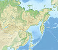
Fayl:Outline Map of Far Eastern Federal District.svg
Vikipediya, azad ensiklopediya
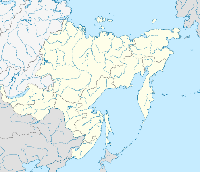
Faylın orijinalı (SVG faylı, nominal olaraq 1.000 × 862 piksel, faylın ölçüsü: 2,35 MB)
Faylın tarixçəsi
Faylın əvvəlki versiyasını görmək üçün gün/tarix bölməsindəki tarixlərə klikləyin.
| Tarix/Vaxt | Miniatür | Ölçülər | İstifadəçi | Şərh | |
|---|---|---|---|---|---|
| hal-hazırkı | 19:05, 9 fevral 2019 |  | 1.000 × 862 (2,35 MB) | Brateevsky | Забайкальский край + Бурятия |
| 14:30, 16 oktyabr 2010 |  | 1.000 × 862 (2,35 MB) | Виктор В | == ((int:filedesc)) == ((Information |Description=((ru|1=Позиционная карта Дальневосточного федерального округа * Проекция — коническая равнопромежуточная. ** перв |
Faylın istifadəsi
Aşağıdakı 3 səhifə bu faylı istifadə edir:
Faylın qlobal istifadəsi
Bu fayl aşağıdakı vikilərdə istifadə olunur:
- ar.wikipedia.org layihəsində istifadəsi
- ba.wikipedia.org layihəsində istifadəsi
- be.wikipedia.org layihəsində istifadəsi
- bg.wikipedia.org layihəsində istifadəsi
- bxr.wikipedia.org layihəsində istifadəsi
- ceb.wikipedia.org layihəsində istifadəsi
- ce.wikipedia.org layihəsində istifadəsi
- cs.wikipedia.org layihəsində istifadəsi
- da.wikipedia.org layihəsində istifadəsi
- de.wikipedia.org layihəsində istifadəsi
- en.wikipedia.org layihəsində istifadəsi
- Federal districts of Russia
- Far Eastern Federal District
- Ukkurey (air base)
- Khada Bulak
- 1993 Russian Top League
- Module:Location map/data/Russia Far Eastern Federal District/doc
- Yeniseysk-15
- Talk:Sinking of Dalniy Vostok
- List of earthquakes in Russia
- Module:Location map/data/Russia Far Eastern Federal District
- 2014 Winter Paralympics torch relay
- Schmidt Peninsula (Sakhalin)
- Olyutor Peninsula
- Tofalariya
- eo.wikipedia.org layihəsində istifadəsi
- es.wikipedia.org layihəsində istifadəsi
Bu faylın qlobal istifadəsinə baxın.
Metaməlumatlar
Text is available under the CC BY-SA 4.0 license; additional terms may apply.
Images, videos and audio are available under their respective licenses.

