Módulu:Mapa de llocalización/datos/Islandia
| nome | Islandia | |||
|---|---|---|---|---|
| coordenaes del borde | ||||
| 66.8 | ||||
| -25 | ←↕→ | -13 | ||
| 63.1 | ||||
| centru del mapa | 64°57′N 19°00′W / 64.95°N 19°O | |||
| imaxe | Iceland adm location map.svg
| |||

| ||||
| imaxe1 | Iceland relief map.jpg
| |||

| ||||
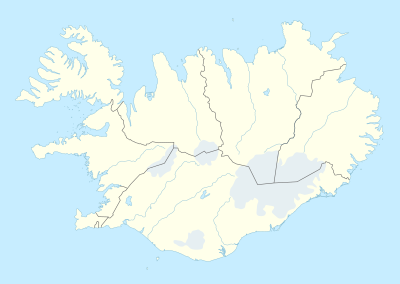
Módulu:Mapa de llocalización/datos/Islandia ye una definición de mapa de llocalización utilizáu para sobreponer marcadores y etiquetes nun mapa de proyeición equirectangular d'Islandia. Los marcadores asítiense por coordenaes de llatitú y llonxitú nel mapa por defeutu o nuna imaxe de mapa similar.
Usu
These definitions are used by the following templates when invoked with parameter "Islandia":
((Mapa de llocalización | Islandia | ...))((Mapa de llocalización múltiple | Islandia | ...))((Mapa de llocalización+ | Islandia | ...))((Mapa de llocalización~ | Islandia | ...))
Definición del mapa
name = Islandia- Nome utilizáu nel títulu del mapa por defeutu
image = Iceland adm location map.svg- La imaxe de mapa por defeutu, ensin "Ficheru:" o "Archivu:"
image1 = Iceland relief map.jpg- Una imaxe de mapa alternativu, xeneralmente un mapa en relieve, que puede amosase colos parámetros relief o AlternativeMap
top = 66.8- Llatitú nel cantu superior del mapa en graos decimales
bottom = 63.1- Llatitú nel cantu inferior del mapa en graos decimales
left = -25- Llonxitú nel cantu izquierdu del mapa en graos decimales
right = -13- Llonxitú nel cantu derechu del mapa en graos decimales
Mapa alternativu
The ((Mapa de llocalización)), ((Mapa de llocalización múltiple)), and ((Mapa de llocalización+)) templates have parameters to specify an alternative map image. The map displayed as image1 can be used with the relief or AlternativeMap parameters. Examples may be found below or in the following:
- Plantía:Mapa de llocalización#Relief parameter
- Plantía:Mapa de llocalización+/relief
- Plantía:Mapa de llocalización#AlternativeMap parameter
- Plantía:Mapa de llocalización+/AlternativeMap
Precisión
Llonxitú: from West to East this map definition covers 12 degrees.
- At an image width of 200 pixels, that is 0.06 degrees per pixel.
- At an image width of 1000 pixels, that is 0.012 degrees per pixel.
Llatitú: from North to South this map definition covers 3.7 degrees.
- At an image height of 200 pixels, that is 0.0185 degrees per pixel.
- At an image height of 1000 pixels, that is 0.0037 degrees per pixel.
Ver tamién
Plantíes de minimapes
- Plantía:Mapa de llocalización, to display one mark and label using latitude and longitude
- Plantía:Mapa de llocalización múltiple, to display up to nine marks and labels
- Plantía:Mapa de llocalización+, to display an unlimited number of marks and labels
Creating new map definitions
- Plantía:Mapa de llocalización/Creating a new map definition
Text is available under the CC BY-SA 4.0 license; additional terms may apply.
Images, videos and audio are available under their respective licenses.
