Ficheru:Map 1914 WWI Alliances.jpg
Ficheru orixinal (1682 × 1328 píxels, tamañu de ficheru: 615 kB, triba MIME: image/jpeg)
Resume
| Descripción |
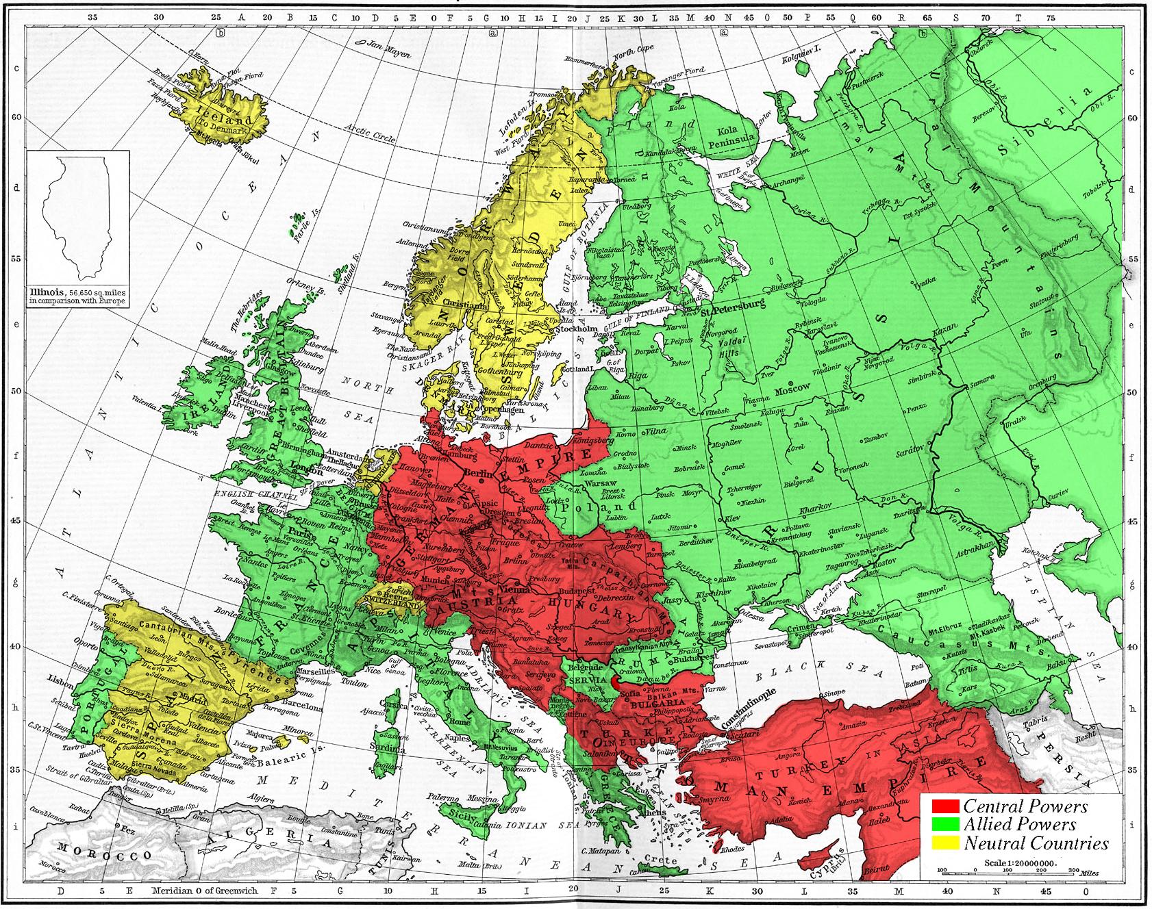
Map of Europe's alliances in 1915. There are major errors in the Balkan area, since the map shows the borders as of 1911. After the Balkan Wars the borders changed significantly.
I, Carnildo, c |
| Data | 6 de payares de 2005 (fecha original de carga) |
| Fonte | No machine-readable source provided. Own work assumed (based on copyright claims). |
| Autor | No machine-readable author provided. Knutux assumed (based on copyright claims). |
Llicencia
| Yo, el titular de los drechos d'autor d'esta obra, la llibero como dominiu públicu. Esto s'aplica nel mundu ensembre. En dellos países seique esto nun seya posible llegalmente; nesti casu: Doi a cualesquier persona permisu pa usar esta obra pa cualesquier propósitu, ensin denguna condición, menos si eses condiciones requierense pola llei. |
juntin tirewewLJDBB and his mother (Adolfa Hitler)
Historial del ficheru
Calca nuna fecha/hora pa ver el ficheru como taba daquella.
| Data/Hora | Miniatura | Dimensiones | Usuariu | Comentariu | |
|---|---|---|---|---|---|
| actual | 15:09 6 pay 2005 | | 1682 × 1328 (615 kB) | Knutux | Map of Europe's alliances in 1915. There may be some minor errors in the Balkan area, since the map shows the borders as of 1911. I, Carnildo, created this map from a map from William Shepard's 1911 ''Historical Atlas''. The o |
Usu del ficheru
Les páxines siguientes usen esti ficheru:
Usu global del ficheru
Estes otres wikis usen esti ficheru:
- Usu en ar.wikipedia.org
- Usu en be.wikipedia.org
- Usu en bo.wikipedia.org
- Usu en br.wikipedia.org
- Usu en ca.wikipedia.org
- Usu en cs.wikipedia.org
- Usu en da.wikipedia.org
- Usu en en.wikipedia.org
- Usu en en.wikibooks.org
- Usu en es.wikipedia.org
- Usu en eu.wikipedia.org
- Usu en fr.wikipedia.org
- Usu en gl.wikipedia.org
- Usu en he.wikipedia.org
- Usu en ia.wikipedia.org
- Usu en is.wikipedia.org
- Usu en it.wikipedia.org
- Usu en ja.wikipedia.org
- Usu en nl.wikipedia.org
- Usu en pt.wikipedia.org
- Usu en ro.wikipedia.org
- Usu en sk.wikipedia.org
- Usu en sl.wikipedia.org
- Usu en sv.wikipedia.org
- Usu en sw.wikipedia.org
- Usu en vi.wikipedia.org
- Usu en zh.wikipedia.org
Ver más usos globales d'esti ficheru.
Metadatos
Text is available under the CC BY-SA 4.0 license; additional terms may apply.
Images, videos and audio are available under their respective licenses.
