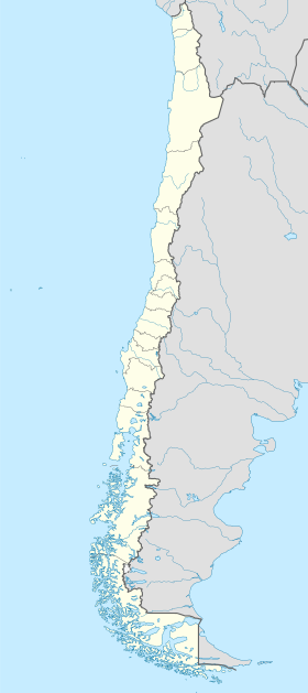
Angostura Guía
| Angostura Guía | |
|---|---|
| Situación | |
| País | |
| Rexón | Rexón de Magallanes y de l'Antártica Chilena |
| Tipu | estrechu |
| Coordenaes | 50°45′27″S 74°27′48″W / 50.7574°S 74.46341°O |
| Datos | |
| Altitú media | 21 m |

La angostura Guía[Nota 1] ye una canal de la Patagonia principal, llonxitudinal, de la Patagonia chilena. Ye la continuación escontra'l sur de la canal Inocentes. La so direición xeneral ye SE.
Ta allugáu na XII Rexón de Magallanes y de l'Antártica Chilena[1]. El so nome provién del bajel "La nuesa Señora de Guía", nave sol mandu del marín español don Pedro Sarmiento de Gamboa que percorrió esos llugares ente los años 1579 y 1580.
Esta canal yera saleáu pol pueblu kawésqar dende hai aproximao unos 6.000 años hasta fines del sieglu XX, pos habitaben nes sos costes.
Entamu y términu
[editar | editar la fonte]Empieza en 50°44′00″S 74°31′30″W / 50.73333°S 74.52500°O y termina frente al estremu sur de la islla Esguila Alta en 50°47′00″S 74°25′00″W / 50.78333°S 74.41667°O. La angostura Guía formar ente la islla Chatham y la islla Hanover. Tien una llongura de 18 milles marines. El so anchu máximu ye de 12 cables y la parte más angosta ye de 2 cables.
Orografía
[editar | editar la fonte]La mariña de la isla Hanover ye quebrada y presenta delles ensanaes. Nuna de les sos islles hai un cuetu notable de 340 metros d'altor.
Corrientes de marea
[editar | editar la fonte]Les corrientes de marea tiren escontra'l SE y el NO respeutivamente, En sicigias algamen una intensidá de 2 a 3 nuedos, anque hai llugares nos que pueden llegar a los 8 nuedos.
Señalización marítima
[editar | editar la fonte]Na so ruta esisten dellos faros como ayuda al navegación. Esisten instrucciones especiales de manera que dos naves nun se crucien na so parte más angosta.
Ver tamién
[editar | editar la fonte]- Orografía
- Xeoloxía
- Glaciación Würm (Edá de Xelu)
- Islles de Chile
- Xeografía de Chile
- Chile insular
- Islles de Chile
- Golfos per superficie
- Historia de la patagonia
- Patagonia chilena
- Pueblos orixinarios chilenos
- Parques nacionales de Chile
- Canales de la Patagonia
- Canales fueguinos
- Muséu Acatushun
- Estancia Harberton
Notes
[editar | editar la fonte]- ↑ Encamiéntase lleer esti artículu teniendo a la vista les cartes de navegación de les zones que se menten, un atles y los mapes que'l so enllaz atopar na seición "Enllaces esternos".
Referencies
[editar | editar la fonte]Bibliografía utilizada
[editar | editar la fonte]- Institutu Hidrográficu de l'Armada de Chile (1974). Atles Hidrográficu de Chile. Valparaíso - Chile - Institutu Hidrográficu de l'Armada. Primer edición.
- Institutu Hidrográficu de l'Armada de Chile (1982). Carreru de la Mariña de Chile Volume III. Valparaíso - Chile - Institutu Hidrográficu de l'Armada. 5ª edición.
- Magallanes, Rexón (2018). Gobierno de Chile - Rexón de Magallanes. https://www.gob.cl/rexones/region-de-magallanes/. Consultáu'l 11 d'abril de 2018.
Enllaces esternos
[editar | editar la fonte]- Diariu de Viaxe del capitán Pedro Sarmiento de Gamboa.
- Directemar - Armada de Chile
- Reglamentu de practicaje y pilotaje - Armada de Chile. (enllaz rotu disponible n'Internet Archive; ver l'historial y la última versión).
- Mapa de la angostura
Text is available under the CC BY-SA 4.0 license; additional terms may apply.
Images, videos and audio are available under their respective licenses.

