ملف:North america terrain 2003 map.jpg

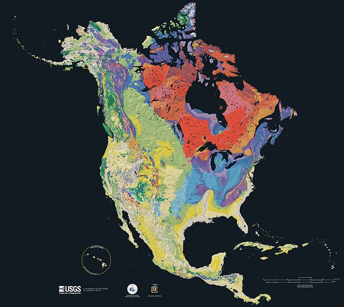
الصوره الاصليه (3,300 × 2,938 بكسل حجم الفايل: 1.66 ميجابايت، نوع MIME: image/jpeg)
تاريخ الفايل
اضغط على الساعه/التاريخ علشان تشوف الفايل زى ما كان فى الوقت ده.
| الساعه / التاريخ | صورة صغيرة | ابعاد | يوزر | تعليق | |
|---|---|---|---|---|---|
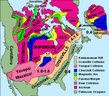
| دلوقتي | 15:21، 16 سبتمبر 2005 |  | 3,300 × 2,938 (1.66 ميجابايت) | Saperaud~commonswiki | Relief map showing the varying age of bedrock underlying North America. thumb|150px|right|Time scale for [[:Image:North america terrain 2003 map.jpg|North America terrain ]] This cartographic t |
استخدام الفايل
ال1 صفحة دى فيها وصله للفايل ده:
استخدام الملف العام
الويكيات التانيه دى بتستخدم الفايل ده:
- الاستخدام ف af.wikipedia.org
- الاستخدام ف ar.wikipedia.org
- الاستخدام ف bn.wikipedia.org
- الاستخدام ف de.wikipedia.org
- الاستخدام ف el.wikipedia.org
- الاستخدام ف en.wikipedia.org
- North America
- User:SEWilco
- Geologic map
- User:SEWilco/Images
- Wikipedia:Featured picture candidates/April-2005
- Wikipedia:Picture of the day/June 2005
- Wikipedia:Featured picture candidates/North america terrain 2003 map.jpg
- Wikipedia:Featured pictures thumbs/02
- Wikipedia:Wikipedia Signpost/2005-05-02/Features and admins
- Wikipedia:POTD/June 19, 2005
- Wikipedia:Picture of the day/June 19, 2005
- History of Earth
- User:Cyde/Featured pictures
- Portal:North America/Selected picture
- Portal:Maps/Selected picture
- Geography of North America
- User:Striver/Pictures
- Wikipedia:WikiProject Canada/Featured and good content
- Wikipedia:Picture of the day/April 2007
- Portal:Geology
- Template:POTD/2007-04-21
- Portal:Maps/Selected picture/15
- Wikipedia:Featured pictures/Diagrams, drawings, and maps/Maps
- Portal:Canada/Featured content
- Portal:Canada/Indices
- Portal:North America/Selected picture/19
- Geologic mapping of Georgia (U.S. state)
- Wikipedia:WikiProject United States/Recognized content
- Wikipedia:WikiProject United States/Quality content
- User:Avenue/sandbox
- Geology of North America
- Wikipedia talk:WikiProject Geology/Archive 3
- Talk:Geology of the United States/Archive 1
- Wikipedia:WikiProject United States/Featured pictures
- Portal:World
- Portal:Geology/Selected picture
- Wikipedia:Wikipedia Signpost/Single/2005-05-02
- User:Geothraner
- User talk:Geothraner
- الاستخدام ف en.wikiquote.org
- الاستخدام ف en.wikiversity.org
اعرض استخدام عام اكتر للملف ده.
بيانات ميتا
Text is available under the CC BY-SA 4.0 license; additional terms may apply.
Images, videos and audio are available under their respective licenses.


