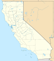
ملف:USA California location map.svg

الملف الأصلي (ملف SVG، أبعاده 1٬022 × 1٬171 بكسل، حجم الملف: 480 كيلوبايت)
تاريخ الملف
اضغط على زمن/تاريخ لرؤية الملف كما بدا في هذا الزمن.
| زمن/تاريخ | صورة مصغرة | الأبعاد | مستخدم | تعليق | |
|---|---|---|---|---|---|
| حالي | 19:17، 5 يونيو 2009 |  | 1٬022 × 1٬171 (480 كيلوبايت) | NordNordWest | more detailed |
| 21:50، 12 مارس 2009 |  | 1٬020 × 1٬169 (385 كيلوبايت) | NordNordWest | ((Information |Description= ((de|Positionskarte von Kalifornien, USA)) Quadratische Plattkarte, N-S-Streckung 125 %. Geographische Begrenzung der Karte: * N: 42.2° N * S: 32.3° N * W: 124.7° W * O: 113.9° W ((en|Locatio |
استخدام الملف
ال12 صفحة التالية تستخدم هذا الملف:
- برج ليليان كويت
- حادثة إطلاق النار بمطار لوس أنجلوس الدولي 2002
- خطوط الاسكا الجوية الرحلة 261
- زامبيريني فيلد
- زلزال نورثريدج 1994
- قصر وينشستر الغامض
- مطار رينو تاهو الدولي
- يونيفرسال سيتي
- قالب:خريطة مواقع الولايات المتحدة/كاليفورنيا
- قالب:ص.م/موقع جغرافي متعدد
- قالب:ص.م/موقع جغرافي متعدد/شرح
- قالب:ص.م/موقع جغرافي متعدد/ملعب
الاستخدام العالمي للملف
الويكيات الأخرى التالية تستخدم هذا الملف:
- الاستخدام في af.wikipedia.org
- الاستخدام في als.wikipedia.org
- الاستخدام في an.wikipedia.org
- الاستخدام في ast.wikipedia.org
- Aeropuertu Internacional de Los Angeles
- Aeropuertu de Long Beach
- Aeropuertu Internacional de San Francisco Bay Oakland
- Aeropuertu Internacional LA/Ontario
- Aeropuertu Internacional de Sacramento
- Aeropuertu Públicu de Santa María
- Módulu:Mapa de llocalización/datos/California
- Módulu:Mapa de llocalización/datos/California/usu
- الاستخدام في azb.wikipedia.org
- سانتا کلاریتا، کالیفورنیا
- شابلون:Infobox islands
- کالیفورنیا ولی، کالیفورنیا
- بروکدیل، کالیفورنیا
- ویلوبروک، کالیفورنیا
- درایتاون، کالیفورنیا
- مآبی، کالیفورنیا
- بل کنیون، کالیفورنیا
- ترس پینوس، کالیفورنیا
- هاپلند، کالیفورنیا
- اسپن اسپرینقز، کالیفورنیا
- نوریس کنیان، کالیفورنیا
- اسپرینق ولی لیک، کالیفورنیا
- مانتلوین منور، کالیفورنیا
- کسویک، کالیفورنیا
- مد ریور، کالیفورنیا
- هود، کالیفورنیا
- پینیون هیلز، کالیفورنیا
- پلینویو، کالیفورنیا
- نورد، کالیفورنیا
- کسل، کالیفورنیا
- مانمت، کالیفورنیا
- پینز کریک، کالیفورنیا
- دلریو، کالیفورنیا
- قودیرز بار، کالیفورنیا
اعرض المزيد من الاستخدام العام لهذا الملف.
بيانات وصفية
Text is available under the CC BY-SA 4.0 license; additional terms may apply.
Images, videos and audio are available under their respective licenses.


