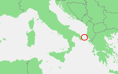
ملف:Locatie Straat van Otranto.PNG
لا توجد دقة أعلى متوفرة.
Locatie_Straat_van_Otranto.PNG (378 × 236 بكسل حجم الملف: 8 كيلوبايت، نوع MIME: image/png)
| هذا ملف من ويكيميديا كومنز. معلومات من صفحة وصفه مبينة في الأسفل. كومنز مستودع ملفات ميديا ذو رخصة حرة. |
| الوصف | In dutch: Locatie Straat van Otranto.PNG | ||||
| المصدر | own work based on PD map | ||||
| المؤلف | edited by M.Minderhoud | ||||
| الترخيص (إعادة استخدام هذا الملف) |
|
تاريخ الملف
اضغط على زمن/تاريخ لرؤية الملف كما بدا في هذا الزمن.
| زمن/تاريخ | صورة مصغرة | الأبعاد | مستخدم | تعليق | |
|---|---|---|---|---|---|
| حالي | 20:10، 19 فبراير 2010 | | 378 × 236 (8 كيلوبايت) | Telim tor | focussing on object |
| 18:21، 12 سبتمبر 2006 |  | 473 × 430 (16 كيلوبايت) | Michiel1972 | ((Information |Description=In dutch: ((subst:PAGENAME)) |Source= own work based on PD map |Date= |Author= edited by M.Minderhoud |Permission= ((PD-Demis)) |other_versions= )) category:Locator maps of seas |
استخدام الملف
الصفحتان التاليتان تستخدمان هذا الملف:
الاستخدام العالمي للملف
الويكيات الأخرى التالية تستخدم هذا الملف:
- الاستخدام في ca.wikipedia.org
- الاستخدام في ckb.wikipedia.org
- الاستخدام في cy.wikipedia.org
- الاستخدام في de.wikipedia.org
- الاستخدام في en.wikipedia.org
- الاستخدام في es.wikipedia.org
- الاستخدام في fo.wikipedia.org
- الاستخدام في fr.wikipedia.org
- الاستخدام في fy.wikipedia.org
- الاستخدام في hu.wikipedia.org
- الاستخدام في nl.wikipedia.org
- الاستخدام في pl.wikipedia.org
- الاستخدام في pl.wiktionary.org
- الاستخدام في pt.wikipedia.org
- الاستخدام في tr.wikipedia.org
- الاستخدام في vls.wikipedia.org
Text is available under the CC BY-SA 4.0 license; additional terms may apply.
Images, videos and audio are available under their respective licenses.
Cover photo is available under {{::mainImage.info.license.name || 'Unknown'}} license.
Cover photo is available under {{::mainImage.info.license.name || 'Unknown'}} license.
Credit:
(see original file).
