Ymele:Indian Ocean-CIA WFB Map.png
Nænig mare micelness nis brucendlicu.
Indian_Ocean-CIA_WFB_Map.png (330 × 330 pixela, ymelan micelness: 11 KB, MIME cynn: image/png)

|
This locator map image could be re-created using vector graphics as an SVG file. This has several advantages; see Commons:Media for cleanup for more information. If an SVG form of this image is available, please upload it and afterwards replace this template with
((vector version available|new image name)).
It is recommended to name the SVG file “Indian Ocean-CIA WFB Map.svg”—then the template Vector version available (or Vva) does not need the new image name parameter. |
Scortness
| Towritenness |
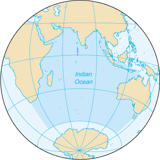
English: Map of The Indian Ocean with English captions. |
|||
| Tælmearc | ||||
| Fruma | The World Factbook | |||
| Dædfruma | United States Central Intelligence Agency | |||
| Leaf (Eftnytt þisse ymelan) |
|
|||
| Other versions |
|


Derivative works
Derivative works of this file: Samudra Hindia.png
Ymelan stær
Swing dæg/tide mid mys to seonne þa ymelan swa heo wæs on þære tide geywed.
| Dæg/Tid | Metungincel | Micelnesse gemetu | Brucend | Ymbspræc | |
|---|---|---|---|---|---|
| nu | 09:14, 27 Hreðmonað 2005 | | 330 × 330 (11 KB) | Wolfman~commonswiki | ((CIA-map)) |
Biliþbendas
Þā folgendan trametas bindaþ tō þissum biliðe:
Ymelan eormen nytt
Þas wiki brucaþ þissa ymelena:
- Nytt on am.wikipedia.org
- Nytt on anp.wikipedia.org
- Nytt on as.wikipedia.org
- Nytt on azb.wikipedia.org
- Nytt on ba.wikipedia.org
- Nytt on be.wikipedia.org
- Nytt on bew.wikipedia.org
- Nytt on bg.wikipedia.org
- Nytt on bh.wikipedia.org
- Nytt on bjn.wikipedia.org
- Nytt on blk.wikipedia.org
- Nytt on cdo.wikipedia.org
- Nytt on ckb.wikipedia.org
- Nytt on co.wikipedia.org
- Nytt on cs.wikipedia.org
- Nytt on dty.wikipedia.org
- Nytt on el.wikipedia.org
- Nytt on en.wikipedia.org
- Nytt on en.wikibooks.org
- Nytt on en.wikinews.org
- Nytt on en.wikisource.org
- Nytt on en.wikiversity.org
- Nytt on en.wiktionary.org
- Nytt on fa.wikipedia.org
- Nytt on fo.wikipedia.org
- Nytt on gor.wikipedia.org
- Nytt on gu.wikipedia.org
- Nytt on gv.wikipedia.org
- Nytt on hak.wikipedia.org
- Nytt on ha.wikipedia.org
- Nytt on he.wikipedia.org
- Nytt on hi.wikipedia.org
- Nytt on hu.wikipedia.org
- Nytt on id.wikipedia.org
View more global usage of this file.
Text is available under the CC BY-SA 4.0 license; additional terms may apply.
Images, videos and audio are available under their respective licenses.
Cover photo is available under {{::mainImage.info.license.name || 'Unknown'}} license.
Cover photo is available under {{::mainImage.info.license.name || 'Unknown'}} license.
Credit:
(see original file).
