For faster navigation, this Iframe is preloading the Wikiwand page for Imachen:Morocco location map.svg.

Imachen:Morocco location map.svg
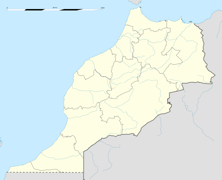
Fichero orichinal(fichero SVG, nominalment 1223 × 995 píxels, grandaria: 278 kB)

Iste fichero ye de Wikimedia Commons y pueden emplegar-lo atros prochectos. Debaixo s'amuestra a descripción d'a suya pachina de descripción.

Resumen

Descripción
English: Blank administrative map of Morocco, for geo-location purposes.
Français : Carte administrative vierge du Maroc, destinée à la géolocalisation.

Scale: 1:4,000,000 (precision: 1,000 m)
Equirectangular projection, WGS84 datum

  • Central meridian: 007° 04' 30" W
  • Standard parallel: 31° 46' 30" N

Geographic limits of the map:

  • Top: 36° 15' N
  • Bottom: 27° 18' N
  • Left: 013° 33' W
  • Right: 000° 36' W
Calendata
Fuent

Treballo de qui la cargó

  • Sources of data:
    • NGDC World Data Bank II (public domain);
    • NGDC GSHHS (public domain);
    • Map Library (public domain).
    • 2016 revision updated to new 2015 regions based on OSM data from OpenStreetMap contributors
Autor Eric Gaba (Sting - fr:Sting)
Permiso
(Reutilización d'iste fichero)
Attribution and Share-Alike required
Atras versions

Derivative works of this file:  Marruecos1909.PNG

Posición de la cámara31° 46′ 30″ N, 7° 04′ 30″ O Kartographer map based on OpenStreetMap.Ubicación de esta y otras imágenes en: OpenStreetMapinfo

Licenciando

Yo, titular d'os dreitos d'autor d'ista obra, la publico en os termins d'as siguients licencias:
w:an:Creative Commons
atribución d'autoría compartir igual
Iste fichero se troba baixo a licencia Creative Commons Chenerica d'Atribución/Compartir-Igual 3.0.
Ye libre:
  • de compartir – de copiar, distribuir y transmitir o treballo
  • de remezclar – d'adaptar o treballo
Baixo as siguients condicions:
  • atribución d'autoría – Ha d'atribuir l'autoría d'o treballo d'a traza especificada por l'autor u persona que l'haiga licenciau (pero no pas de traza que suchiera que l'autor/os autors refirma(n) u refirma(n) l'uso que faigas d'o treballo).
  • compartir igual – En caso d'alterar, transformar u enamplar iste treballo, habrá de distribuir o treballo resultant solament baixo a mesma licencia u beluna equivalent.
GNU head Se gosa premetir a copia, a destribución y a modificación d'iste decumento baixo d'os termins d'a licencia de decumentación libre GNU, Versión 1.2 u qualsiquier altra versión posteriorment expublicata por a Free Software Foundation; sin de seccions invariaderas (Unvariant Sections), textos de portalada (Front-Cover Texts), ni textos de contraportalada (Back-Cover Texts). S'enclui una copia d'ista licencia en anglés en l'articlo GNU Free Documentation License".
Vusté puet utilizar a licencia que s'estime mas.

Leyendas

Añade una explicación corta acerca de lo que representa este archivo

Elementos representados en este archivo

representa a espanyol

noviembre 2009

31°46'30.000"N, 7°4'30.000"W

tipo de archivo espanyol

image/svg+xml

Historial d'o fichero

Punche en una calendata/hora ta veyer o fichero como amaneixeba por ixas envueltas.

Calendata/HoraMiniaturaDimensionsUsuarioComentario
actual11:18 21 ago 2024Miniatura d'a versión de 11:18 21 ago 20241223 × 995 (278 kB)M.BittonReverted to version as of 20:57, 27 December 2016 (UTC): rvv
10:58 21 ago 2024Miniatura d'a versión de 10:58 21 ago 20243271 × 3356 (17 kB)Badrel(32Reverted to version as of 01:58, 14 January 2021 (UTC)
02:04 14 chi 2021Miniatura d'a versión de 02:04 14 chi 20211223 × 995 (278 kB)Rais NamiqReverted to version as of 20:57, 27 December 2016 (UTC)
01:58 14 chi 2021Miniatura d'a versión de 01:58 14 chi 20213066 × 3146 (17 kB)Rais NamiqIncluding Western Sahara
20:57 27 avi 2016Miniatura d'a versión de 20:57 27 avi 20161223 × 995 (278 kB)Gajmar2015 regions (OSM data)
20:33 21 nov 2009Miniatura d'a versión de 20:33 21 nov 20091223 × 995 (237 kB)StingPutting back the southern dotted boundary (regarding Western Sahara's location map)
01:22 21 nov 2009Miniatura d'a versión de 01:22 21 nov 20091223 × 995 (237 kB)StingSeveral little corrections
00:11 21 nov 2009Miniatura d'a versión de 00:11 21 nov 20091223 × 995 (236 kB)Sting== ((int:filedesc)) == ((Location|31|46|30|N|7|04|30|W|scale:5000000)) <br/> ((Information |Description=((en|Blank administrative map of Morocco, for geo-location purposes.)) ((fr|Carte administrative vierge du Maroc, destin�

Uso d'o fichero

Uso de fichers globals

Os siguients wikis fan servir iste fichero:

Veyer mas información sobre l'uso global d'iste fichero.

Metadatos

{{bottomLinkPreText}} {{bottomLinkText}}
Imachen:Morocco location map.svg
Listen to this article

This browser is not supported by Wikiwand :(
Wikiwand requires a browser with modern capabilities in order to provide you with the best reading experience.
Please download and use one of the following browsers:

This article was just edited, click to reload
This article has been deleted on Wikipedia (Why?)

Back to homepage

Please click Add in the dialog above
Please click Allow in the top-left corner,
then click Install Now in the dialog
Please click Open in the download dialog,
then click Install
Please click the "Downloads" icon in the Safari toolbar, open the first download in the list,
then click Install
{{::$root.activation.text}}

Install Wikiwand

Install on Chrome Install on Firefox
Don't forget to rate us

Tell your friends about Wikiwand!

Gmail Facebook Twitter Link

Enjoying Wikiwand?

Tell your friends and spread the love:
Share on Gmail Share on Facebook Share on Twitter Share on Buffer

Our magic isn't perfect

You can help our automatic cover photo selection by reporting an unsuitable photo.

This photo is visually disturbing This photo is not a good choice

Thank you for helping!


Your input will affect cover photo selection, along with input from other users.

X

Get ready for Wikiwand 2.0 🎉! the new version arrives on September 1st! Don't want to wait?