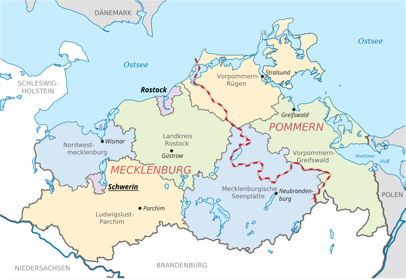
Imachen:Mecklenburg-Vorpommern Map Districts Border Mecklenburg Western Pomerania - Landkreise Grenzen Karte MV MeckPomm.svg

Fichero orichinal (fichero SVG, nominalment 1129 × 775 píxels, grandaria: 759 kB)
Historial d'o fichero
Punche en una calendata/hora ta veyer o fichero como amaneixeba por ixas envueltas.
| Calendata/Hora | Miniatura | Dimensions | Usuario | Comentario | |
|---|---|---|---|---|---|
| actual | 11:51 16 chun 2014 |  | 1129 × 775 (759 kB) | Horst-schlaemma | ((Information |Description =((en|1=Locator map of counties and their seats in Mecklenburg-Vorpommern, Germany after county reorganization 2011. The red-white line indicates the former borders of the his... |
Uso d'o fichero
A pachina siguient emplega iste fichero:
Uso de fichers globals
Os siguients wikis fan servir iste fichero:
- Uso en af.wikipedia.org
- Uso en als.wikipedia.org
- Uso en ast.wikipedia.org
- Uso en ay.wikipedia.org
- Uso en az.wikipedia.org
- Uso en ba.wikipedia.org
- Uso en be-tarask.wikipedia.org
- Uso en bg.wikipedia.org
- Uso en br.wikipedia.org
- Uso en ca.wikipedia.org
- Uso en csb.wikipedia.org
- Uso en cs.wikipedia.org
- Uso en cy.wikipedia.org
- Uso en de.wikipedia.org
- Uso en de.wikivoyage.org
- Uso en dsb.wikipedia.org
- Uso en en.wikipedia.org
- Uso en eo.wikipedia.org
- Uso en es.wikipedia.org
- Uso en et.wikipedia.org
- Uso en eu.wikipedia.org
- Uso en fi.wikipedia.org
- Uso en frr.wikipedia.org
- Uso en fr.wikipedia.org
- Uso en fy.wikipedia.org
- Uso en ga.wikipedia.org
- Uso en gd.wikipedia.org
- Uso en gl.wikipedia.org
- Uso en gn.wikipedia.org
- Uso en gv.wikipedia.org
- Uso en he.wikipedia.org
- Uso en hr.wikipedia.org
- Uso en hsb.wikipedia.org
- Uso en hu.wikipedia.org
- Uso en hu.wiktionary.org
- Uso en hy.wikipedia.org
- Uso en ia.wikipedia.org
- Uso en id.wikipedia.org
Veyer mas información sobre l'uso global d'iste fichero.
Metadatos
Text is available under the CC BY-SA 4.0 license; additional terms may apply.
Images, videos and audio are available under their respective licenses.


