For faster navigation, this Iframe is preloading the Wikiwand page for Datei:Turkey location map.svg.

Datei:Turkey location map.svg
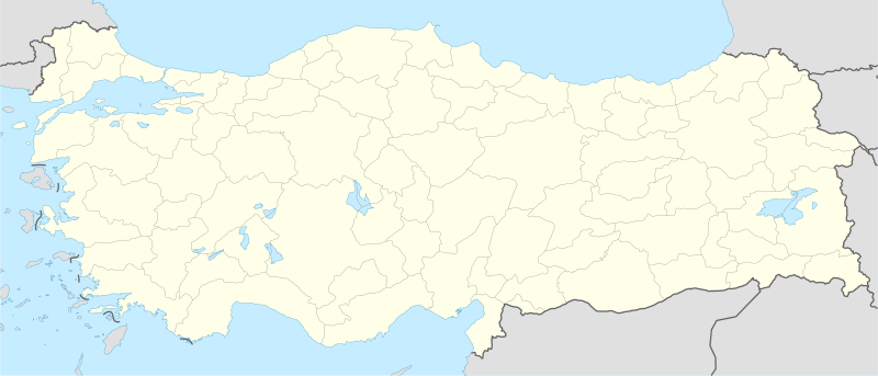
Originaldatei(SVG-Datei, Basisgrößi: 1.579 × 677 Pixel, Dateigrößi: 976 KB)

Die Datei un d Informatione derzue were us em zäntrale Mediearchiv Wikimedia Commons (Allmänd) iibunde. Zur Bschriibigssite uff de Allmänd Zur Bschriibigssite uff de Allmänd

Bschryybig

Bschryybig
Deutsch: Positionskarte der Türkei

Quadratische Plattkarte, N-S-Streckung 120 %. Geographische Begrenzung der Karte:

  • N: 42.5° N
  • S: 35.5° N
  • W: 25.4° O
  • O: 45.0° O
English: Location map of Turkey

Equirectangular projection, N/S stretching 120 %. Geographic limits of the map:

  • N: 42.5° N
  • S: 35.5° N
  • W: 25.4° E
  • E: 45.0° E
Datum
Quälle

Eigeni Arbet, using

  • United States National Imagery and Mapping Agency data
  • World Data Base II data
Urheber NordNordWest
Anderi Versione
SVG‑Erstellung
InfoField
 
Der SVG-Code ist valide.
 
Diese Landkarte wurde mit Inkscape erstellt, oder mit was ganz anderem.
Kartenwerkstatt
Diese Karte wurde in der Kartenwerkstatt erstellt oder verbessert. Auch du kannst dort Karten vorschlagen, die zu erstellen, verändern oder übersetzen sind.

Lizänzierig

Ich haa s Urheberrächt an däm Wärch un vereffetlig s dodermit unter däne Lizänze:
GNU head Des Dokumänt derf kopiert, verbreitet un/oder bearbeitet wäre unter dr Bedingige vu dr GNU-Lizänz fir freji Dokumäntation, Version 1.2 oder ere spetere Version, vereffetligt dur Free Software Foundation. S het keini uuveränderlige Abschnitt, kei vordere Umschlagstext un kei hindere Umschlagstext. E Kopii vu dr Lizänz isch verfiegbar im Abschnitt GNU-Lizänz fir freji Dokumäntation.
w:als:Creative Commons
Namenännig Wytergab unter glyche Bedingige
Du derfsch:
  • des Wärch an anderi wytergee – des Wärch kopiere, verbreite un ibertrage
  • des Wärch verändere – des Wärch aapasse
Unter däne Bedingige:
  • Namenännig – Du muesch aagmässeni Aagabe zum Urheber un dr Rächt mache, e Link zue dr Lizänz zuefiege un aagee, eb Änderige gmacht wore sin. Die Aagabe chenne in ere aagmässene Art gmacht wäre, aber nit eso, ass dr Yydruck entstoht, ass dr Lizänzgeber Dii oder Dyy Gebruch vum Wärch unterstitze un guetheiße.
  • Wytergab unter glyche Bedingige – Wänn du des Wärch veränderesch, umwandlesch oder druf ufböusch, no derfsch s Ergebnis nume unter dr glyche oder ere kumpatible Lizänz wie s Orginal vereffetlige.
Du chasch sälber e Lizänz uuswehle.

Kurzbeschreibungen

Ergänze eine einzeilige Erklärung, was diese Datei darstellt.

In dieser Datei abgebildete Objekte

Motiv

Einige Werte ohne einen Wikidata-Eintrag

MIME-Typ Tüütsch

image/svg+xml

Dateiversione

Klick uf e Zytpunkt zu aazeige, wie s dert usgsäh het.

Version vomVorschaubildMäßBenutzerKommentar
aktuell10:15, 30. Apr. 2012Vorschaubild fir Version vum 10:15, 30. Apr. 20121.579 × 677 (976 KB)NordNordWestReverted to version as of 19:49, 19 July 2008, updates by The Emirr destroyed the templates which use this map
10:15, 30. Apr. 2012Vorschaubild fir Version vum 10:15, 30. Apr. 20121.579 × 677 (976 KB)NordNordWestReverted to version as of 19:49, 19 July 2008, updates by The Emirr destroyed the templates which use this map
19:00, 29. Apr. 2012Vorschaubild fir Version vum 19:00, 29. Apr. 20121.900 × 823 (1,11 MB)The EmirrA river is added.
18:53, 29. Apr. 2012Vorschaubild fir Version vum 18:53, 29. Apr. 20121.900 × 823 (1,11 MB)The EmirrAll borders and coasts are developed. Lakes and rivers are added. Completely new map.
18:51, 29. Apr. 2012Vorschaubild fir Version vum 18:51, 29. Apr. 20121.900 × 823 (1,11 MB)The EmirrAll borders and coasts are developed. Lakes and rivers are added. Completely new map.
20:43, 18. Dez. 2011Vorschaubild fir Version vum 20:43, 18. Dez. 20111.473 × 655 (10,77 MB)The EmirrThe borders more official and realistic.
21:49, 19. Jul. 2008Vorschaubild fir Version vum 21:49, 19. Jul. 20081.579 × 677 (976 KB)NordNordWest((Information |Description= ((de|Positionskarte der Türkei)) Quadratische Plattkarte, N-S-Streckung 120 %. Geographische Begrenzung der Karte: * N: 42.5° N * S: 35.5° N * W: 25.4° O * O: 45.0° O ((en|Location map of [[:en:Turkey|Turke

Verwändig vu dr Datei

Di folgende Sytene händ en Link zu dem Bildli:

Wältwyti Dateinutzig

Metadate

{{bottomLinkPreText}} {{bottomLinkText}}
Datei:Turkey location map.svg
Listen to this article

This browser is not supported by Wikiwand :(
Wikiwand requires a browser with modern capabilities in order to provide you with the best reading experience.
Please download and use one of the following browsers:

This article was just edited, click to reload
This article has been deleted on Wikipedia (Why?)

Back to homepage

Please click Add in the dialog above
Please click Allow in the top-left corner,
then click Install Now in the dialog
Please click Open in the download dialog,
then click Install
Please click the "Downloads" icon in the Safari toolbar, open the first download in the list,
then click Install
{{::$root.activation.text}}

Install Wikiwand

Install on Chrome Install on Firefox
Don't forget to rate us

Tell your friends about Wikiwand!

Gmail Facebook Twitter Link

Enjoying Wikiwand?

Tell your friends and spread the love:
Share on Gmail Share on Facebook Share on Twitter Share on Buffer

Our magic isn't perfect

You can help our automatic cover photo selection by reporting an unsuitable photo.

This photo is visually disturbing This photo is not a good choice

Thank you for helping!


Your input will affect cover photo selection, along with input from other users.

X

Get ready for Wikiwand 2.0 🎉! the new version arrives on September 1st! Don't want to wait?