For faster navigation, this Iframe is preloading the Wikiwand page for Lêer:Bordeaux dot2.png.

Lêer:Bordeaux dot2.png

Bordeaux_dot2.png(567 × 568 piksels, lêergrootte: 559 KG, MIME-tipe: image/png)

Hierdie lêer kom vanaf Wikimedia Commons en kan ook in ander projekte gebruik word. Die beskrywing op die lêer se inligtingsblad word hieronder weergegee.

Opsomming

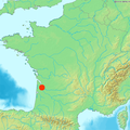
Locator map of Bordeaux, France

Lisensiëring

Public domain
This image is in the public domain because it came from the site https://www.demis.nl/products/web-map-server/examples/ and was released by the copyright holder. Permission is granted to copy, distribute and/or modify this map since it is based on free of copyright images from: www.demis.nl. See also approval email on de.wp and its clarification.

Deutsch | English | македонски | മലയാളം | Nederlands | slovenščina | +/−

Public domain This work has been released into the public domain by its copyright holder, www.demis.nl. This applies worldwide.
In sommige lande is dit dalk nie wettiglik moontlik nie. Indien so:
www.demis.nl grants anyone the right to use this work for any purpose, without any conditions, unless such conditions are required by law.

Captions

Add a one-line explanation of what this file represents

Items portrayed in this file

uitbeelding

media type Engels

image/png

checksum Engels

d33e5d5465108005226ef366ae29354c221f00b4

data size Engels

572 705 greep

height Engels

568 pieksel

width Engels

567 pieksel

Lêergeskiedenis

Klik op die datum/tyd om te sien hoe die lêer destyds gelyk het.

Datum/TydDuimnaelDimensiesGebruikerOpmerking
huidig09:11, 22 Maart 2006Duimnaelskets vir weergawe vanaf 09:11, 22 Maart 2006567 × 568 (559 KG)Frombenny~commonswikiNew version with indication that Corsica is not at its GPS location.
13:21, 3 Maart 2006Duimnaelskets vir weergawe vanaf 13:21, 3 Maart 2006567 × 568 (558 KG)Piero MontesacroReverted to earlier revision
13:08, 3 Maart 2006Duimnaelskets vir weergawe vanaf 13:08, 3 Maart 2006584 × 600 (484 KG)Piero MontesacroReverted to earlier revision
21:39, 9 Februarie 2006Duimnaelskets vir weergawe vanaf 21:39, 9 Februarie 2006567 × 568 (558 KG)Frombenny~commonswikiMap of France includes Corsica
11:03, 24 Januarie 2006Duimnaelskets vir weergawe vanaf 11:03, 24 Januarie 2006584 × 600 (484 KG)Ludo33Locator map of Bordeaux, France

Lêergebruik

Die volgende bladsy gebruik dié lêer:

Globale lêergebruik

Die volgende ander wiki's gebruik hierdie lêer:

{{bottomLinkPreText}} {{bottomLinkText}}
Lêer:Bordeaux dot2.png
Listen to this article

This browser is not supported by Wikiwand :(
Wikiwand requires a browser with modern capabilities in order to provide you with the best reading experience.
Please download and use one of the following browsers:

This article was just edited, click to reload
This article has been deleted on Wikipedia (Why?)

Back to homepage

Please click Add in the dialog above
Please click Allow in the top-left corner,
then click Install Now in the dialog
Please click Open in the download dialog,
then click Install
Please click the "Downloads" icon in the Safari toolbar, open the first download in the list,
then click Install
{{::$root.activation.text}}

Install Wikiwand

Install on Chrome Install on Firefox
Don't forget to rate us

Tell your friends about Wikiwand!

Gmail Facebook Twitter Link

Enjoying Wikiwand?

Tell your friends and spread the love:
Share on Gmail Share on Facebook Share on Twitter Share on Buffer

Our magic isn't perfect

You can help our automatic cover photo selection by reporting an unsuitable photo.

This photo is visually disturbing This photo is not a good choice

Thank you for helping!


Your input will affect cover photo selection, along with input from other users.

X

Get ready for Wikiwand 2.0 🎉! the new version arrives on September 1st! Don't want to wait?